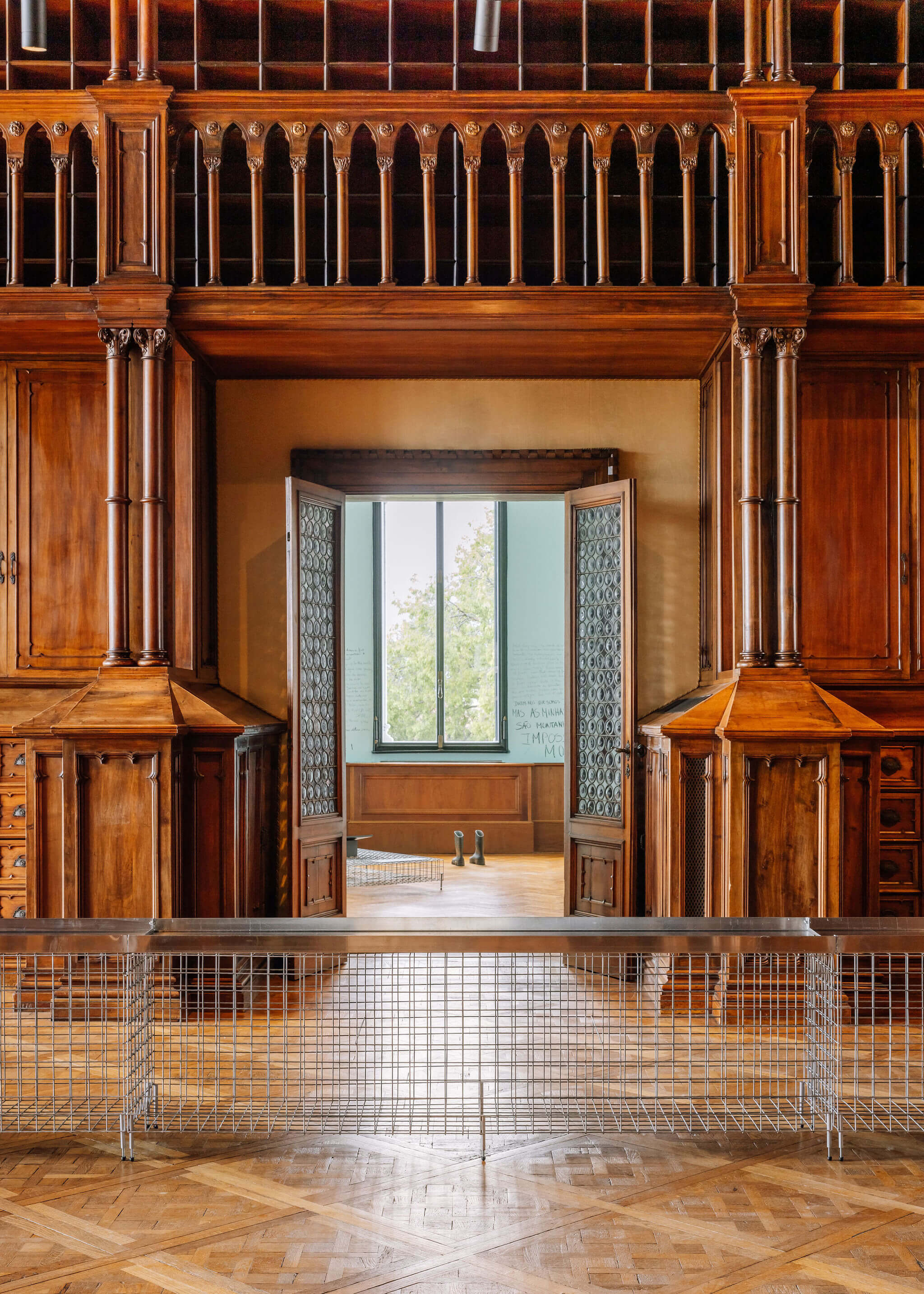
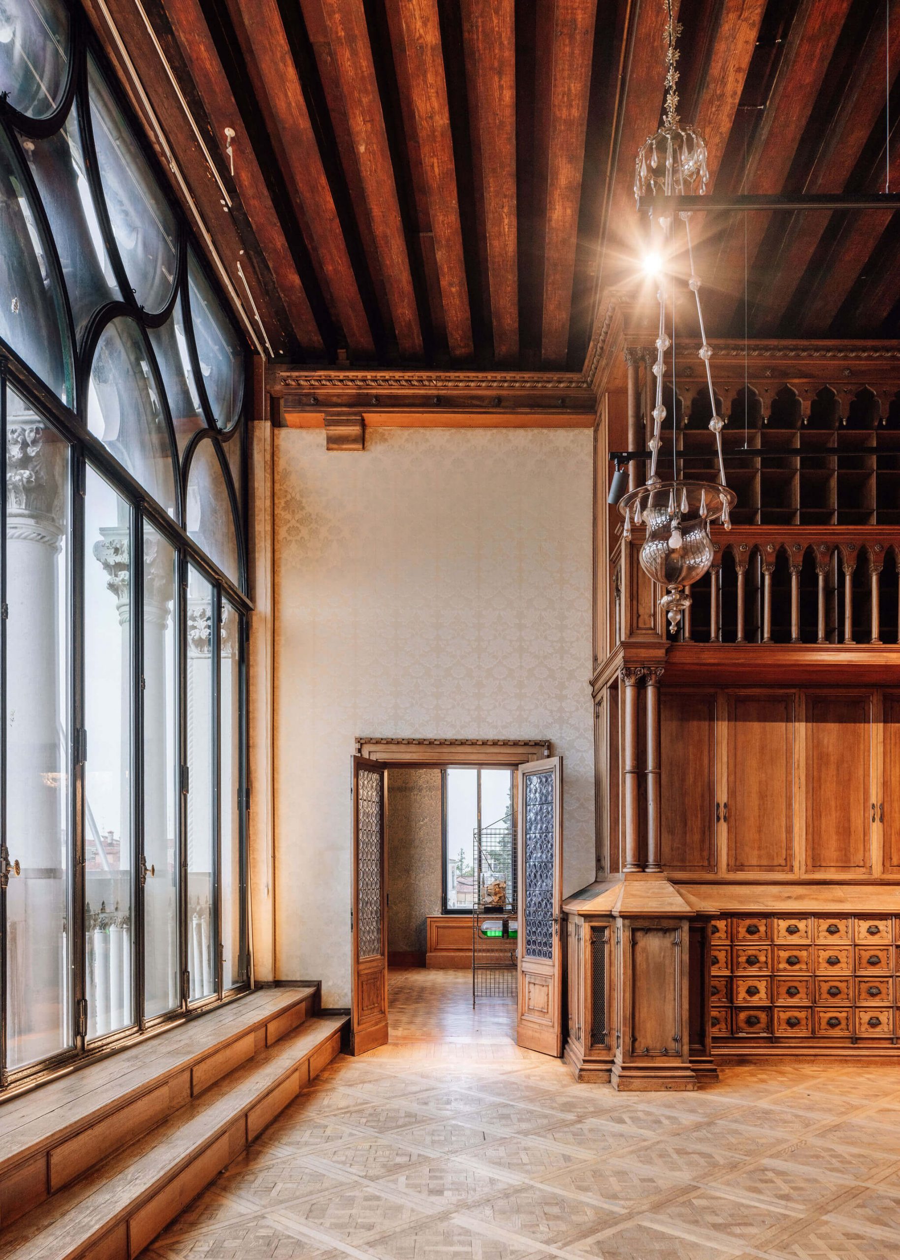
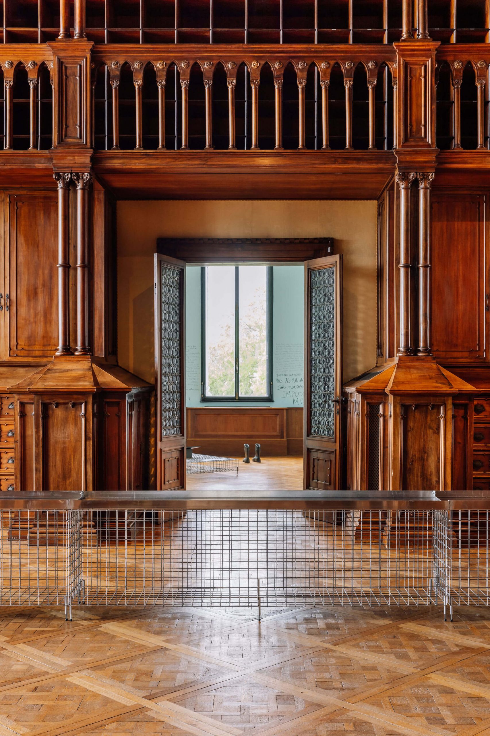
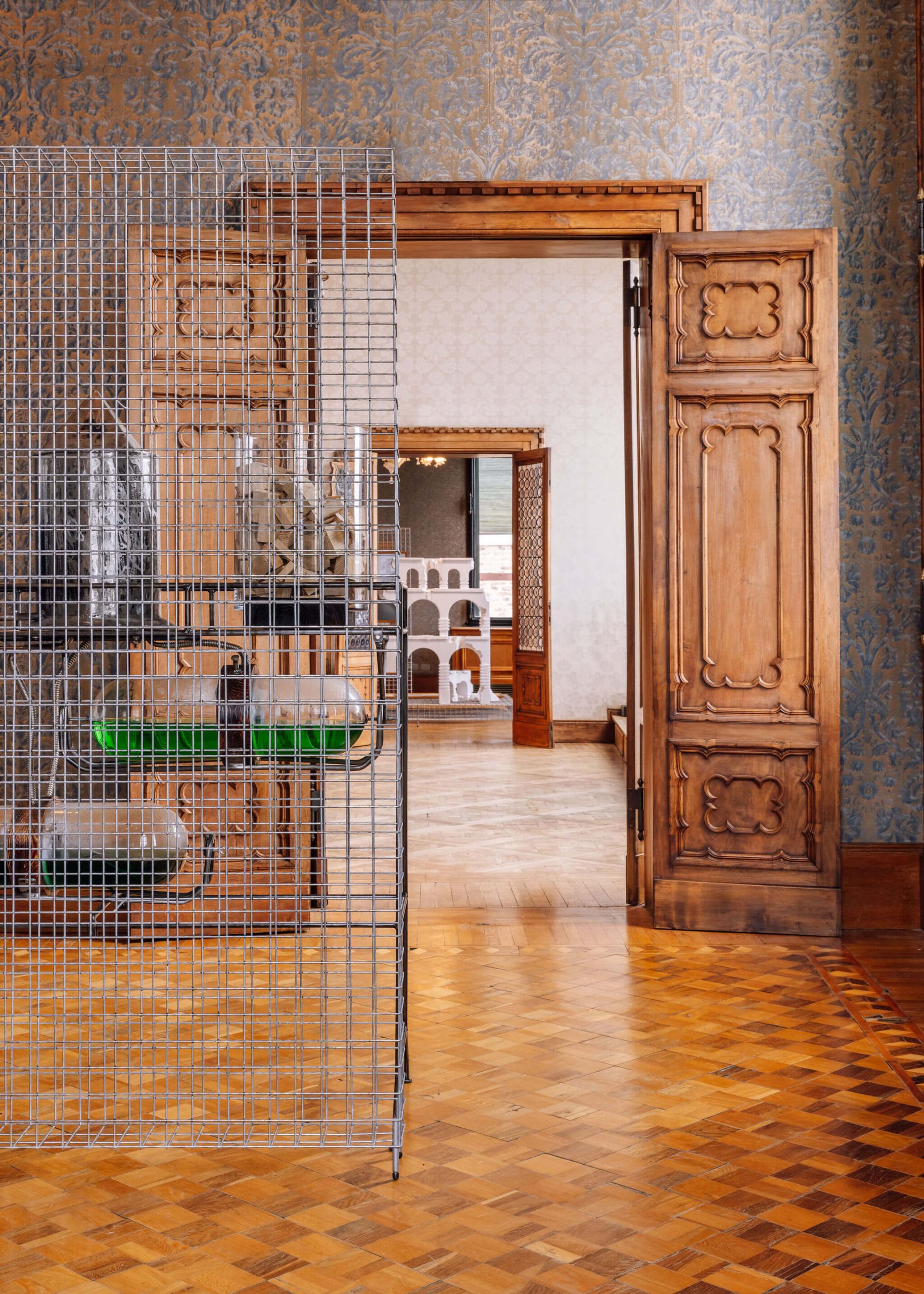
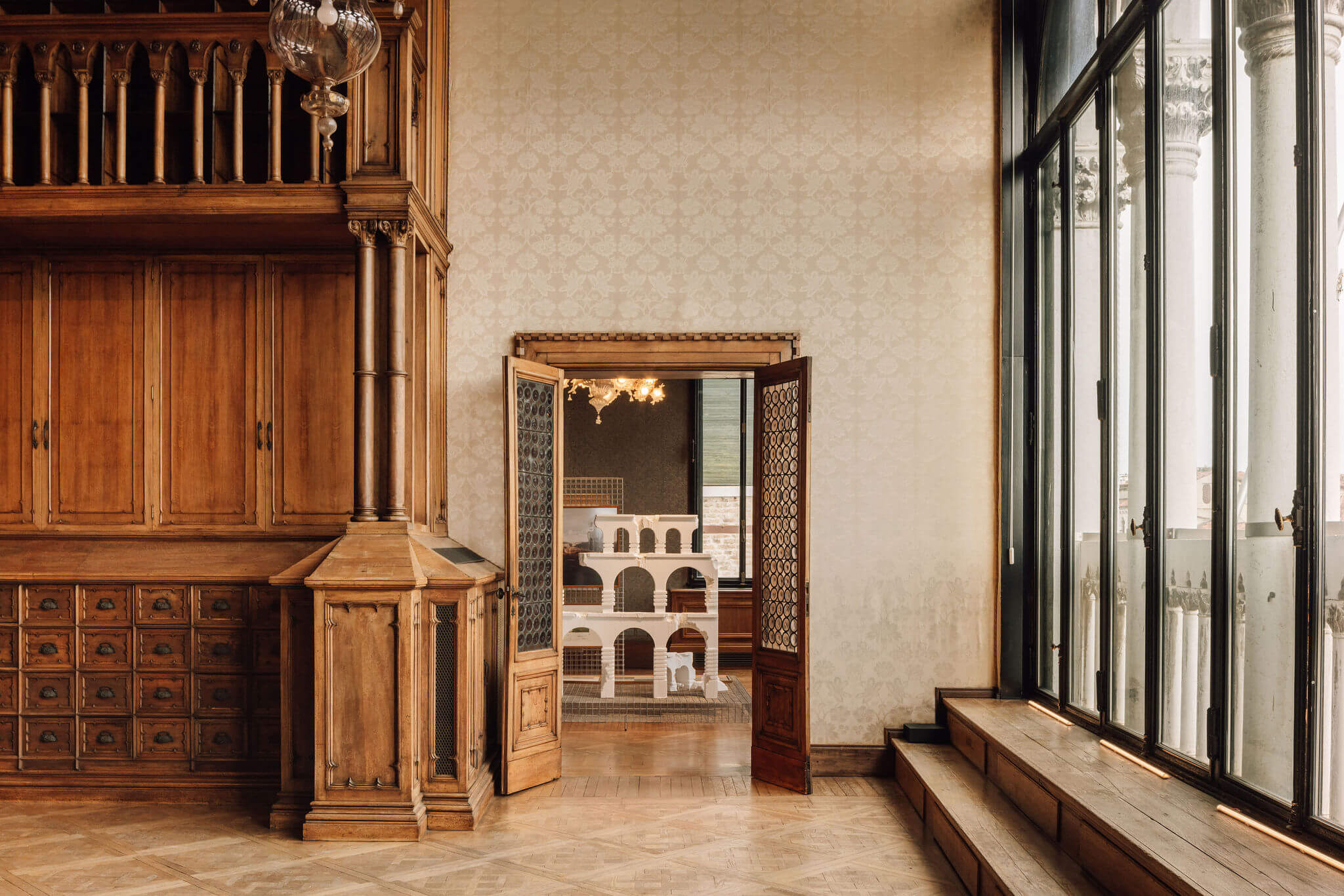
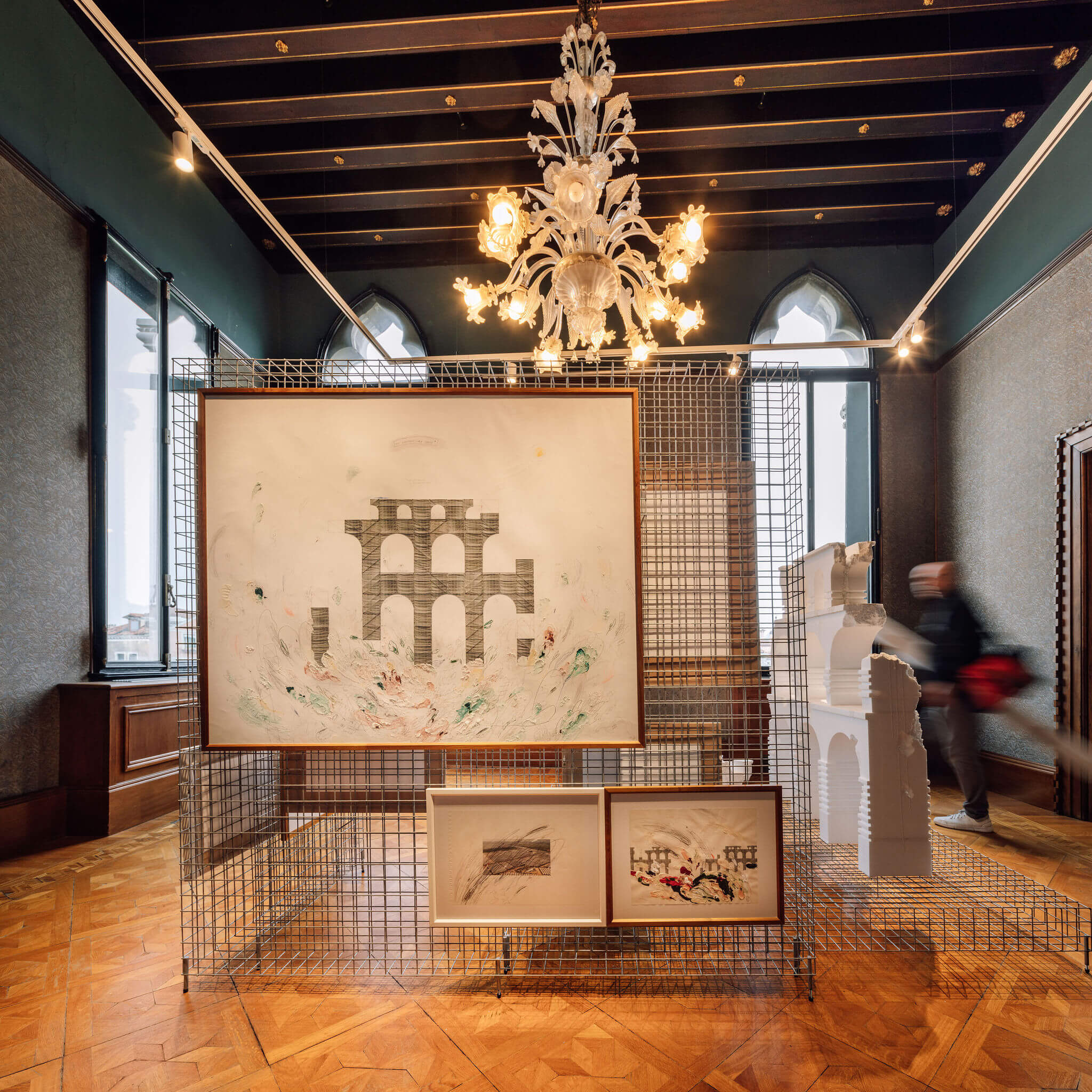
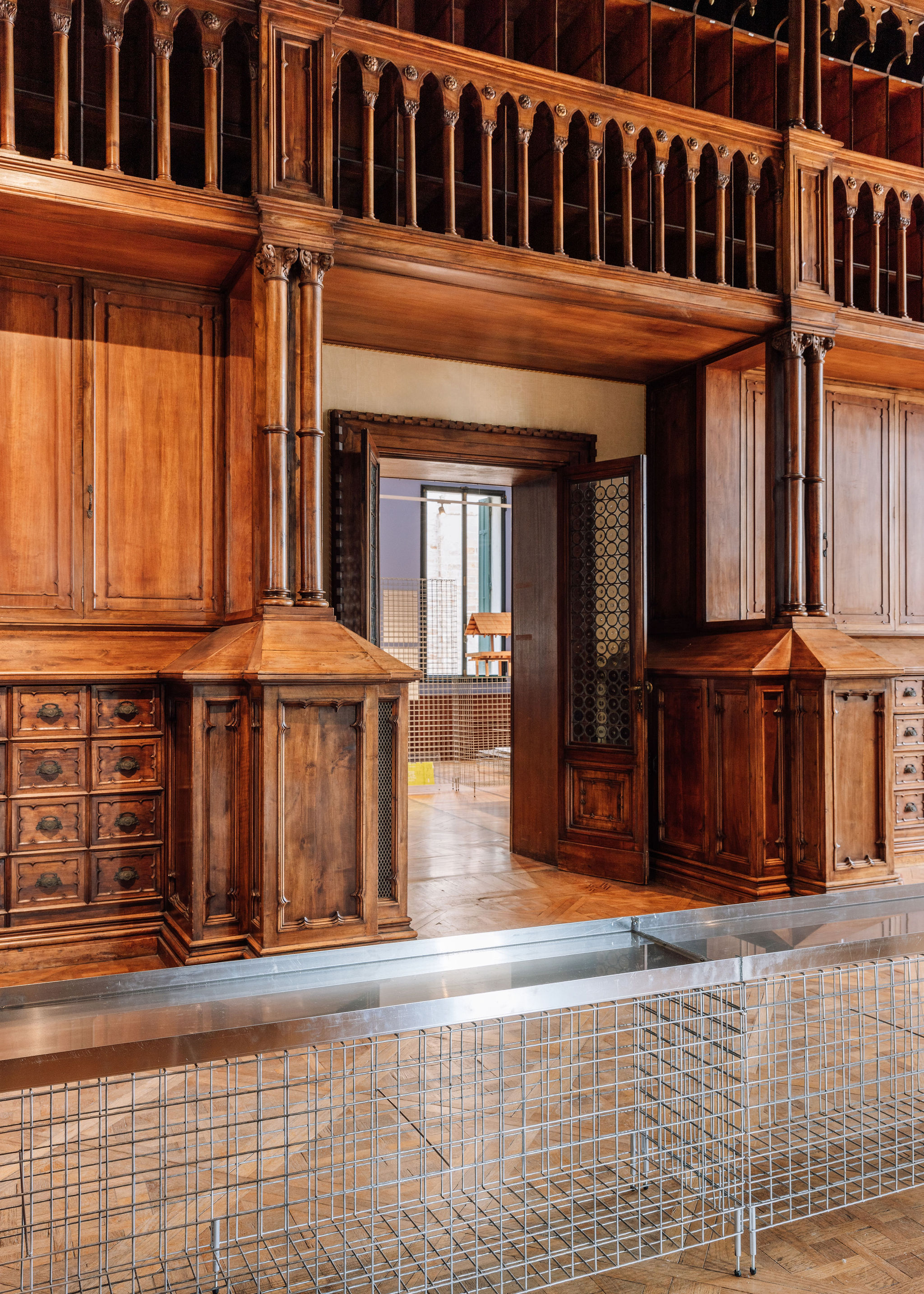
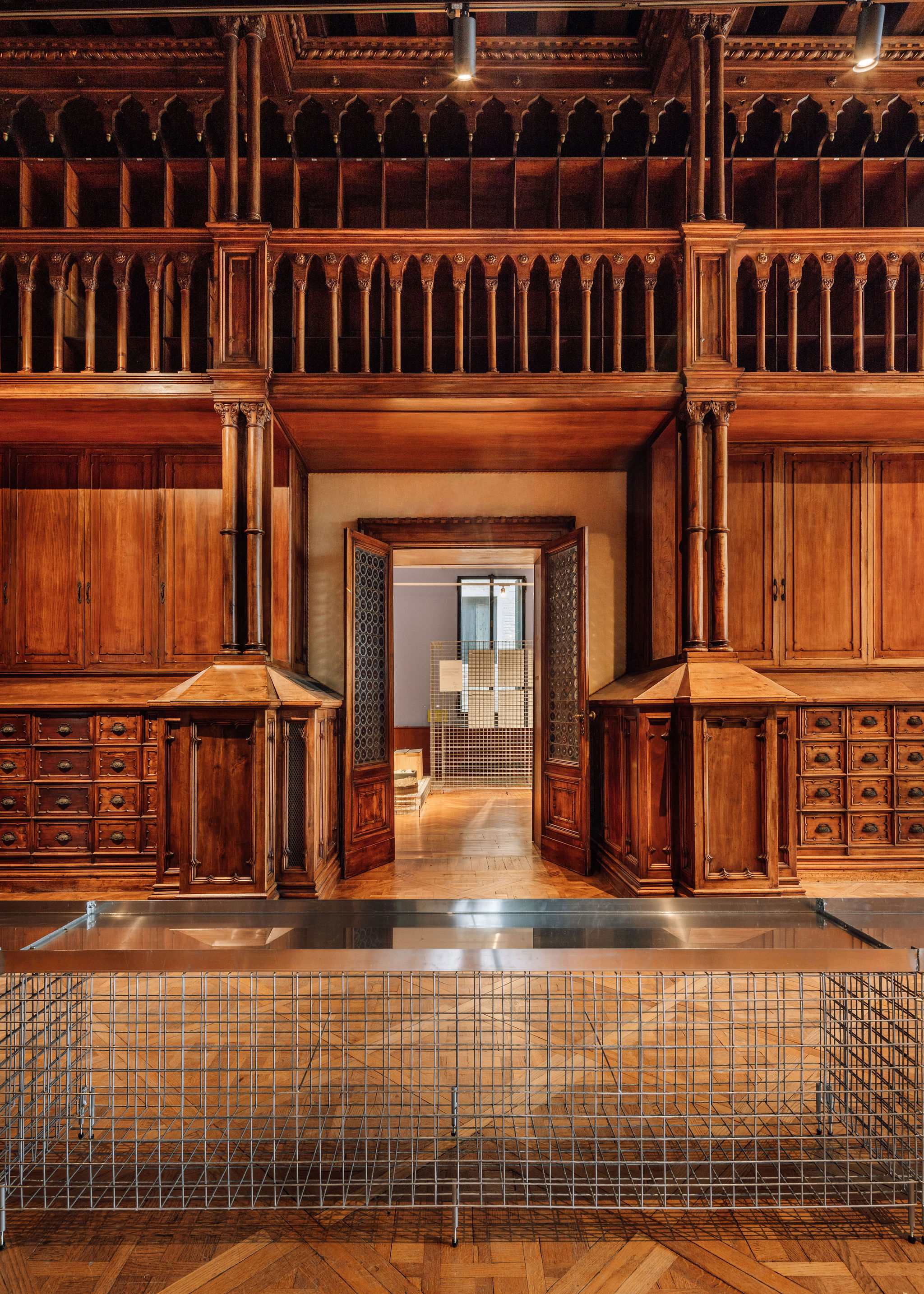
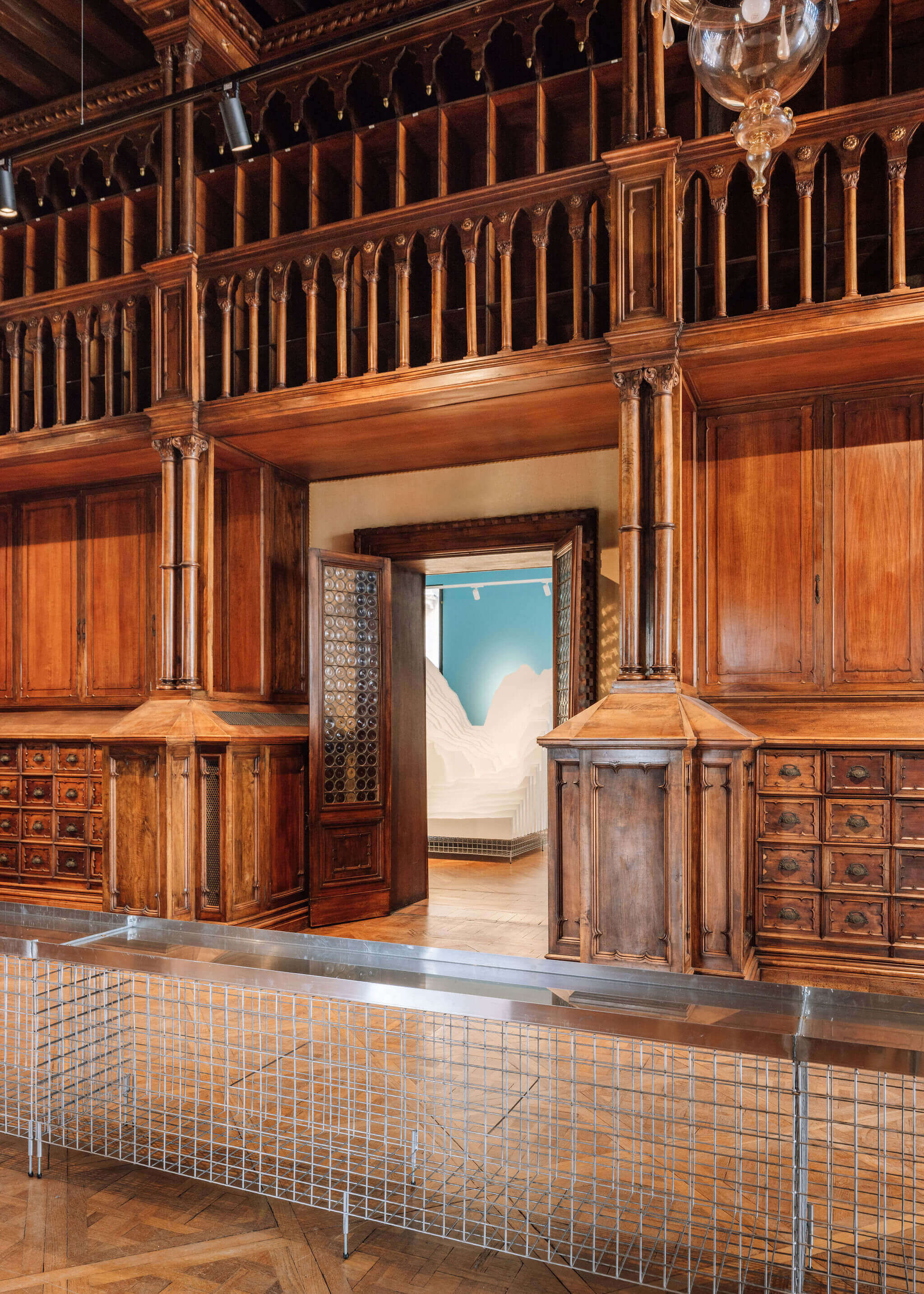
Palazzo Franchetti
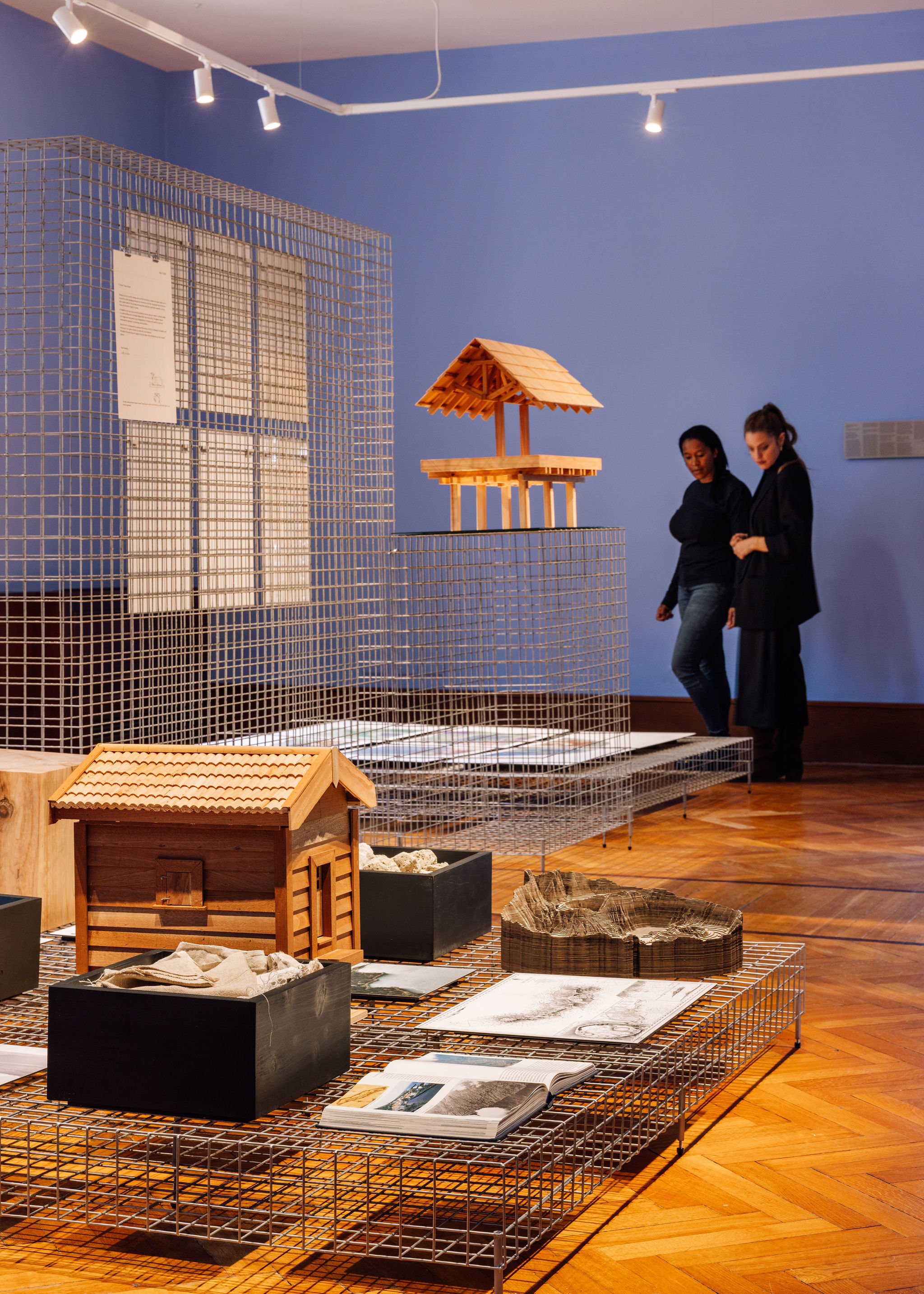
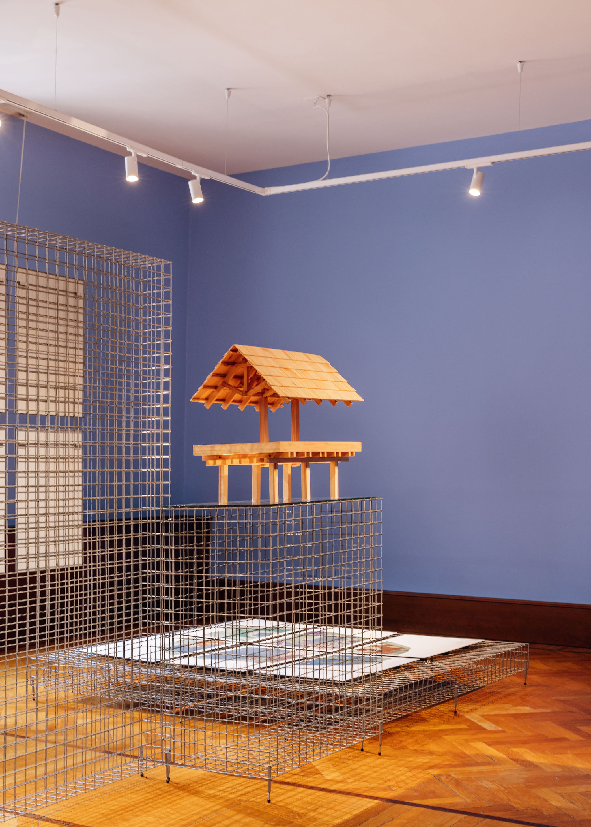
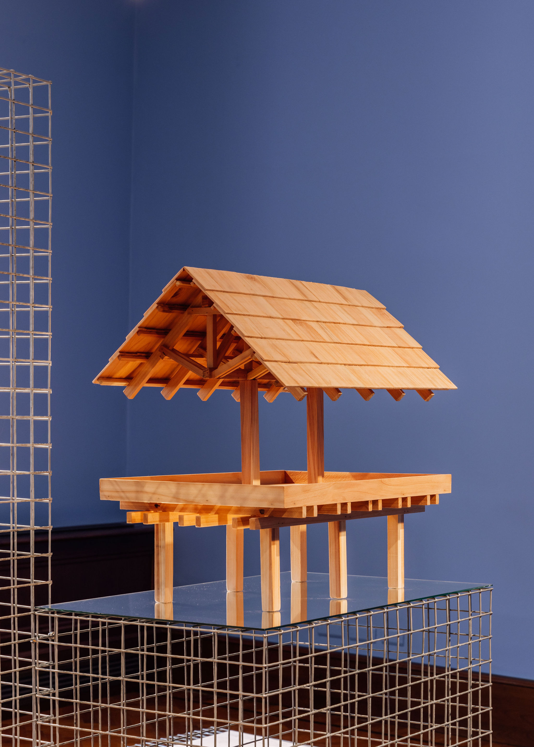
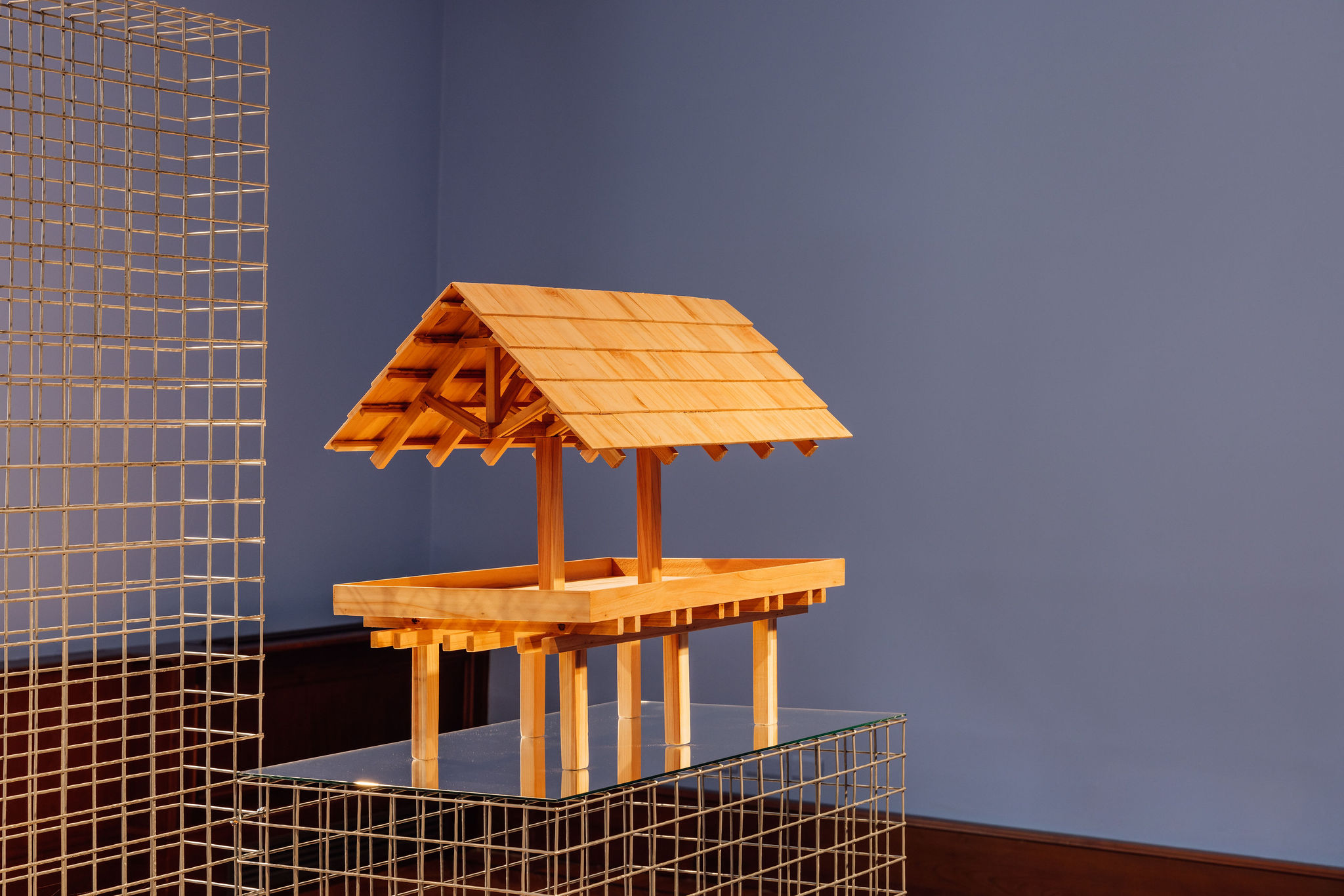
The water of the Tâmega Basin, once at the heart of all the irrigated land, is today the primary resource for one of Europe’s largest green hydro energy plants. The Tâmega Electroproducer System, also known as Gigabattery, has brought significant changes to the region by demonstrating the contrast between two ways of managing water: as a local and common asset and as a commercial product for creating energy. By exploring ways to connect the different scales and time, a dialogue begins, born of the mediating capacity of architecture, seeking to mitigate the impact of this metamorphosis of the local territory, flora, fauna and human life.
A hydro-methodology, realised through critical spatial experimentation, combines immersive analysis with a performative play as an architectonic proposition to reimagine the concept of the common in the management of the Tâmega’s water. The analytical research, which is here denoted as Tâmega hypertext, enhances the contrasts and connections between different hydro architectures in the region, the distinctive ways in which the water is managed and how it relates to humans and non-humans. By drawing on hydro-artefacts and a play tour – performed and played in March 2023 and recorded on documentary film – it divulges poetic methods which seek to reconcile the existing tensions surrounding water, while also uncovering paths that lead to the design of dialogues that look forward to more collective futures over the Tâmega and beyond.
ACKNOWLEDGMENTS Alberto Oliveira, Alexandre Gonçalves, Aquela Kombucha, Carlos Alberto, Eduardo Queiroga, Fernando Morgado, Filipe Dora, João Ribeiro, Lais Pereira, Luís Lima, Manuel Gonçalves, Miguel Tavares, Município de Ribeira de Pena, Município de Vila Pouca de Aguiar, Ricardo Machado, Rui Barbosa, Sofia Barreiros, Xirobloc, XPIM 3D

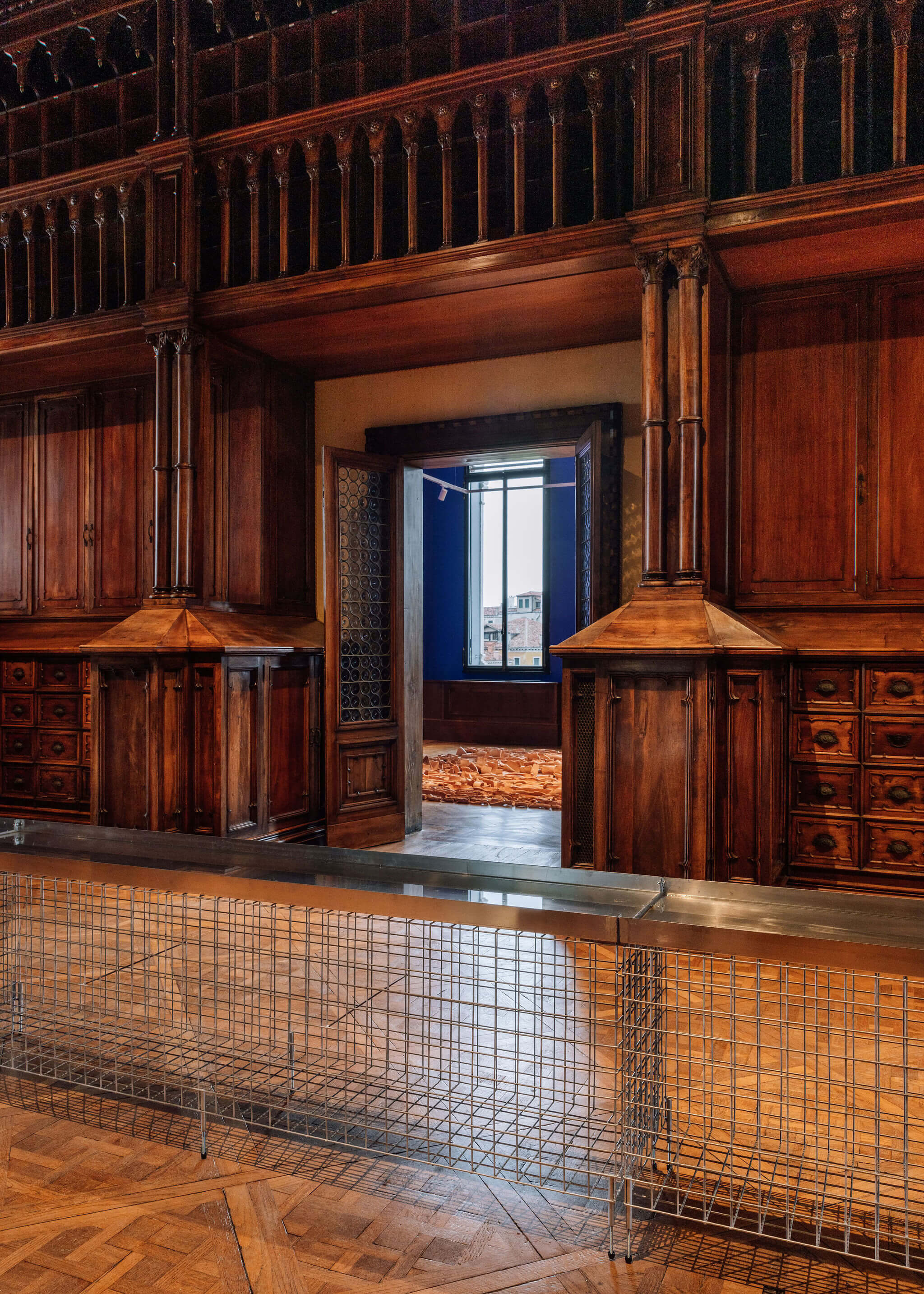
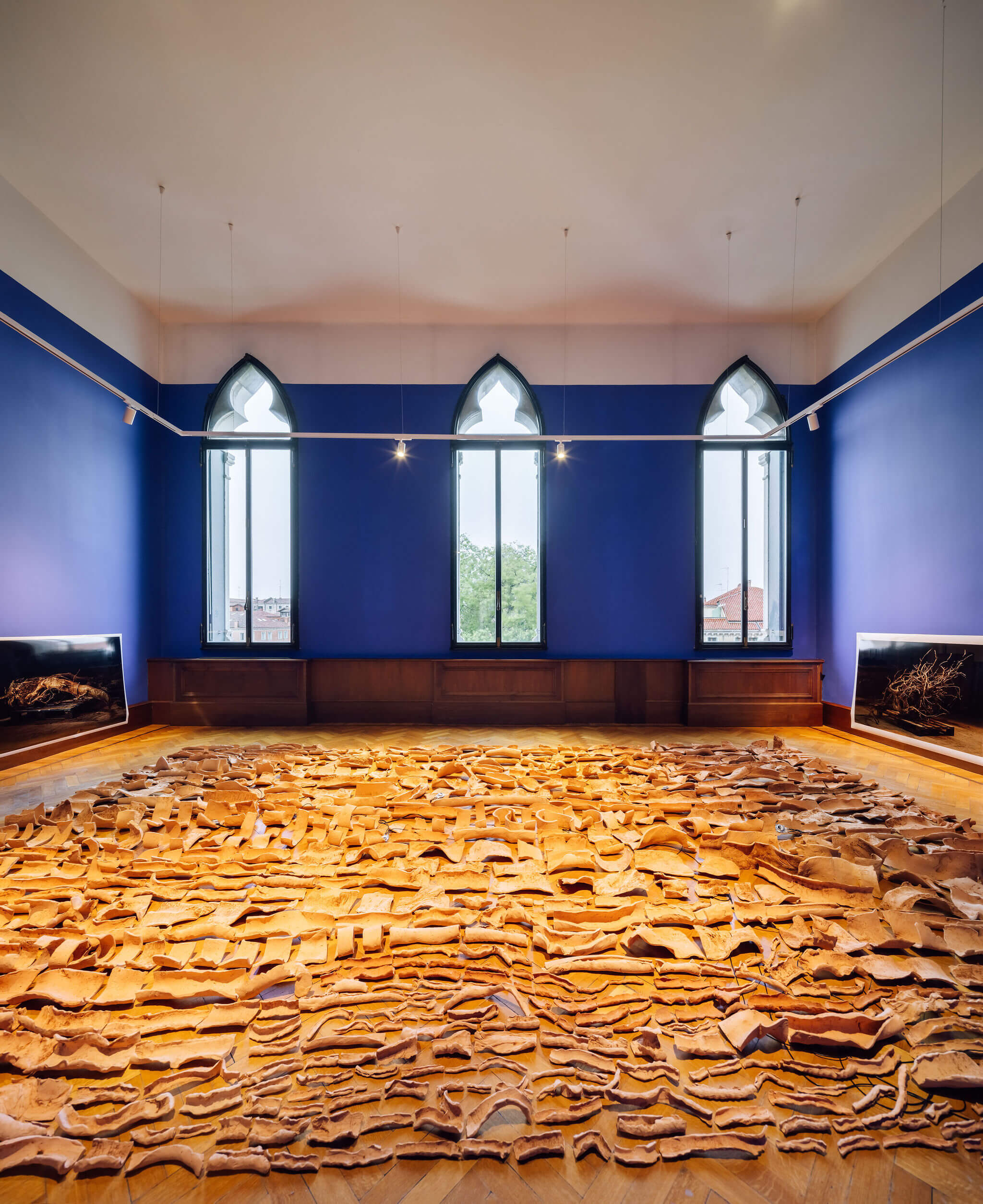
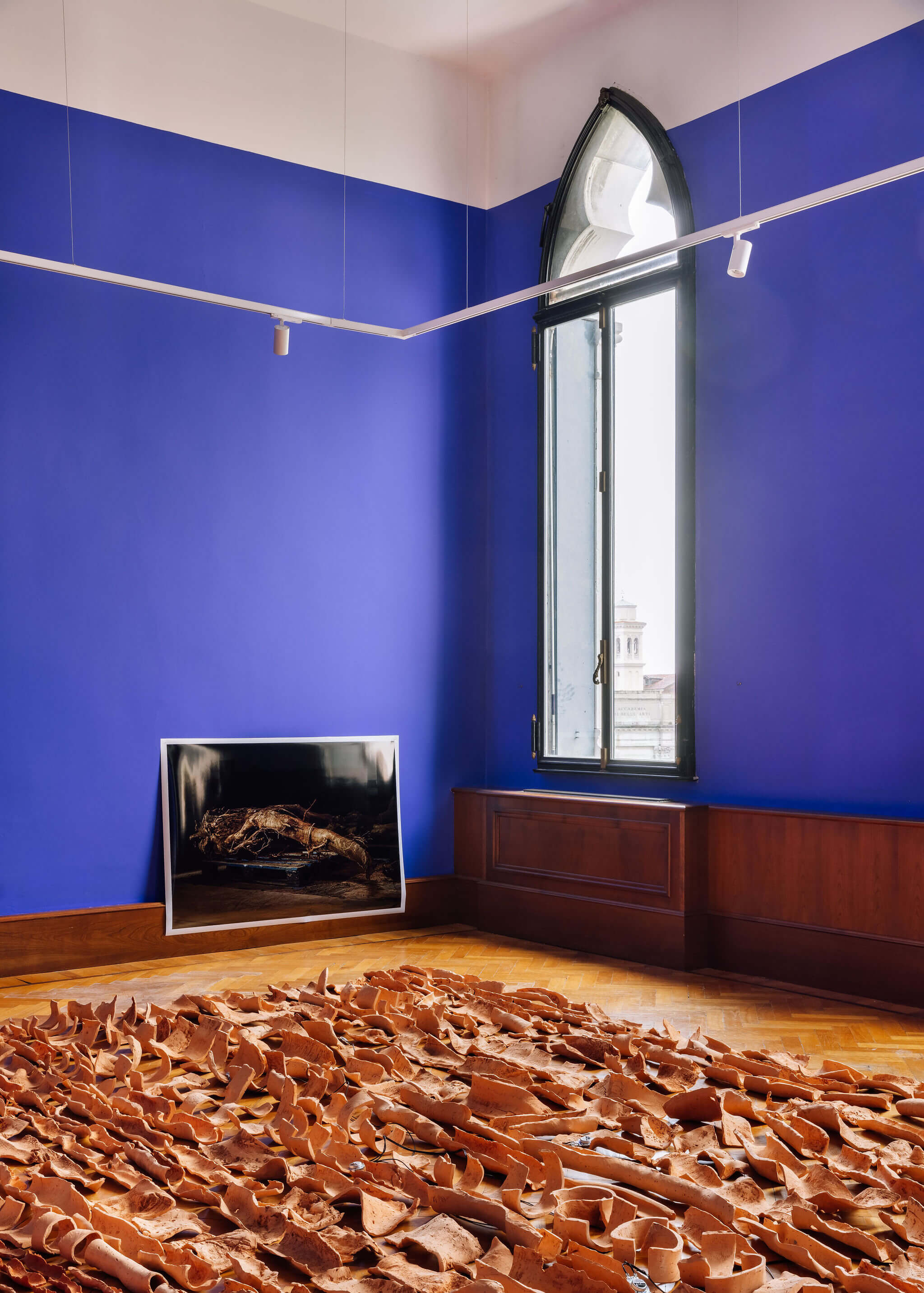
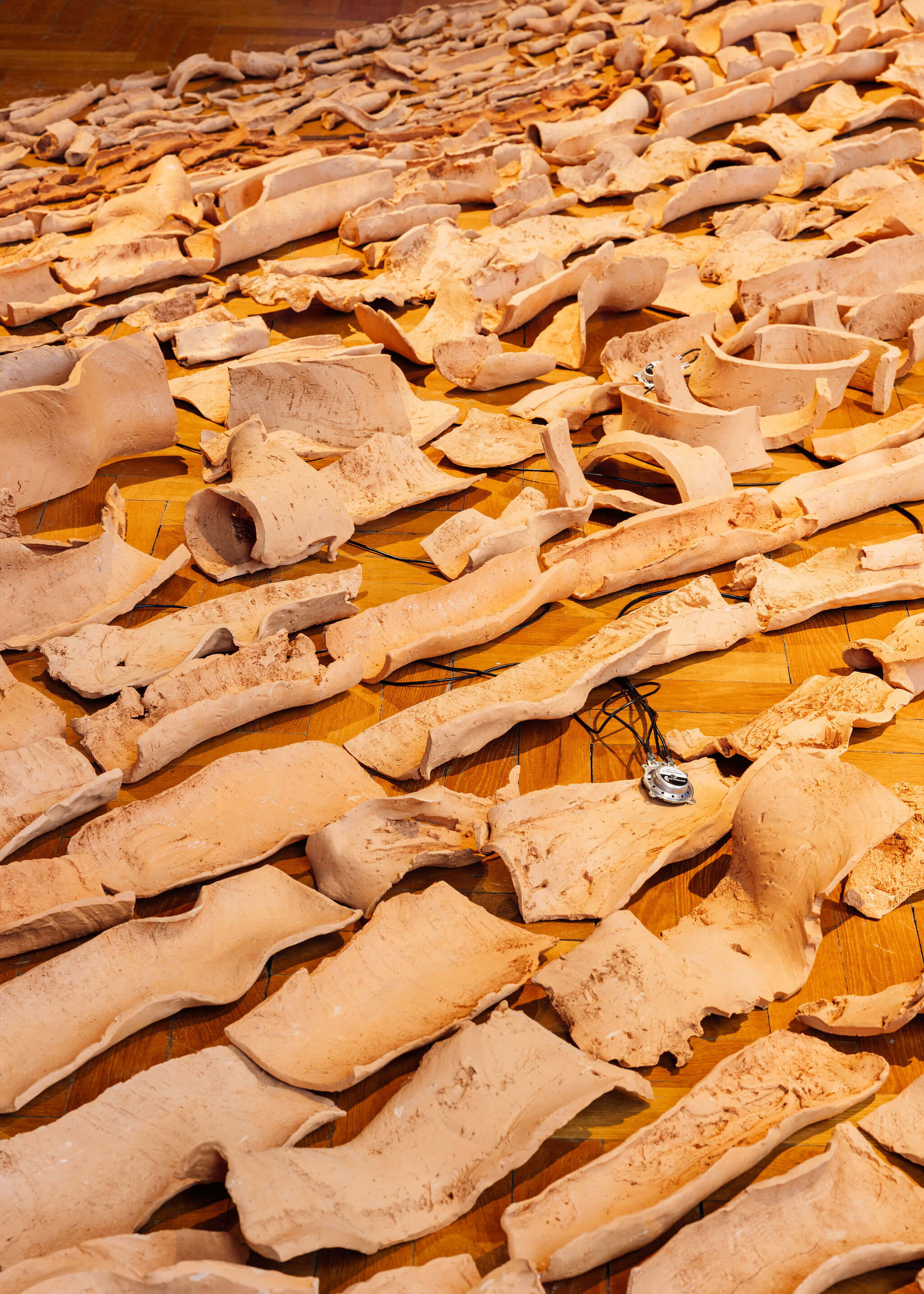
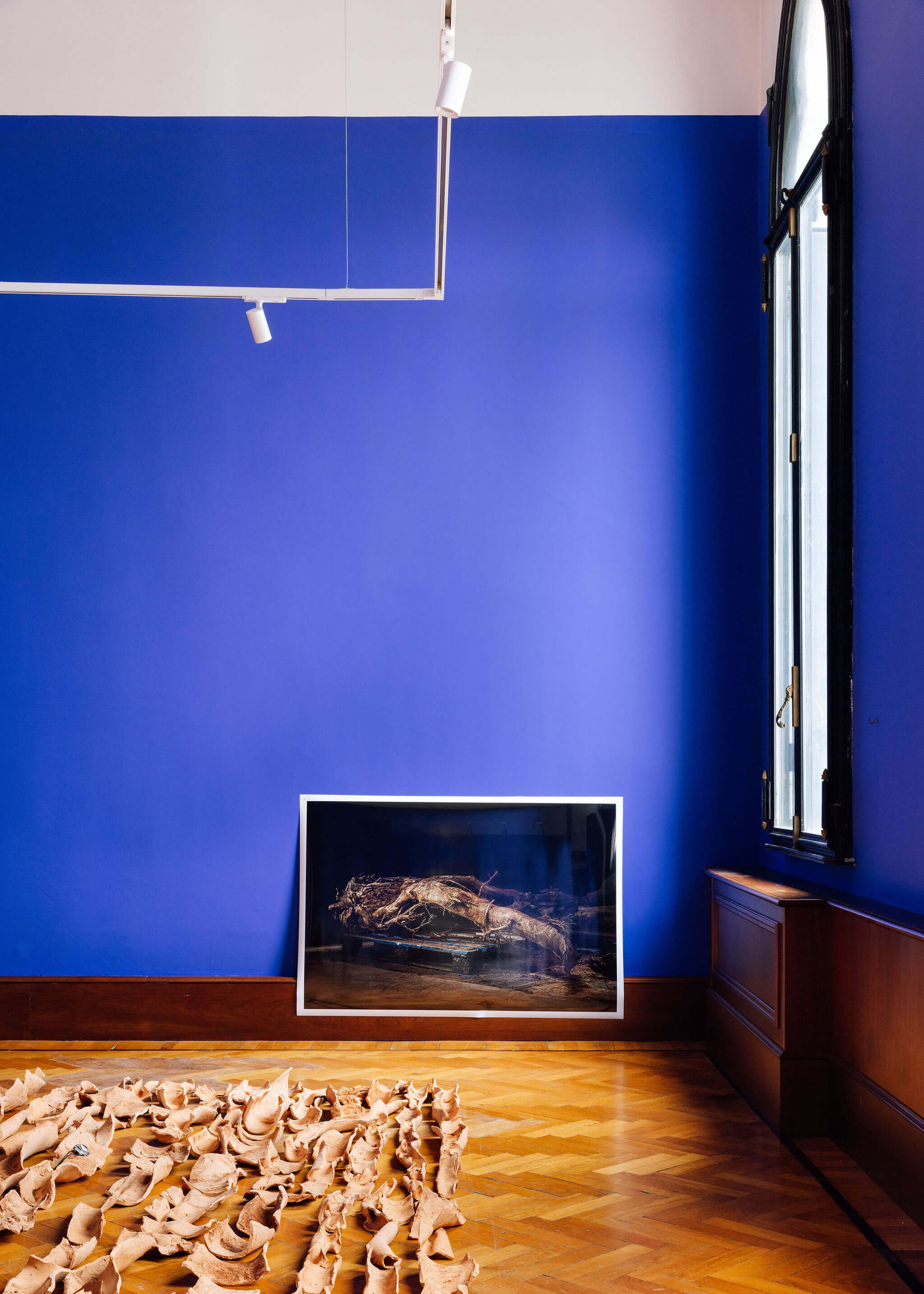
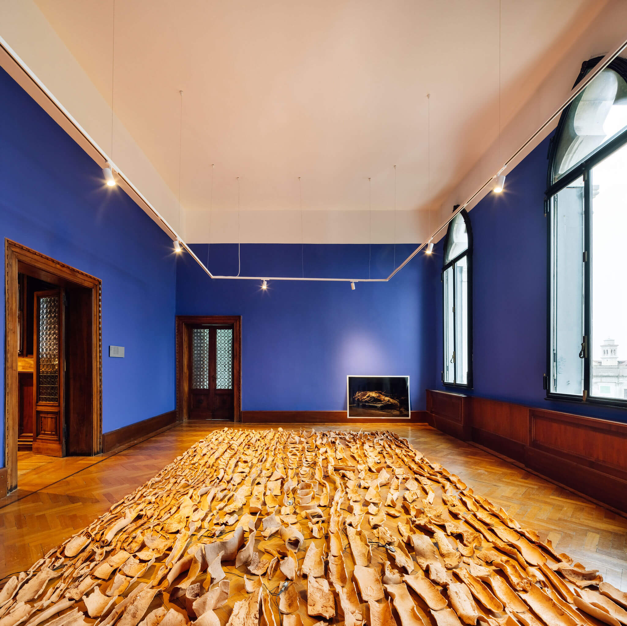
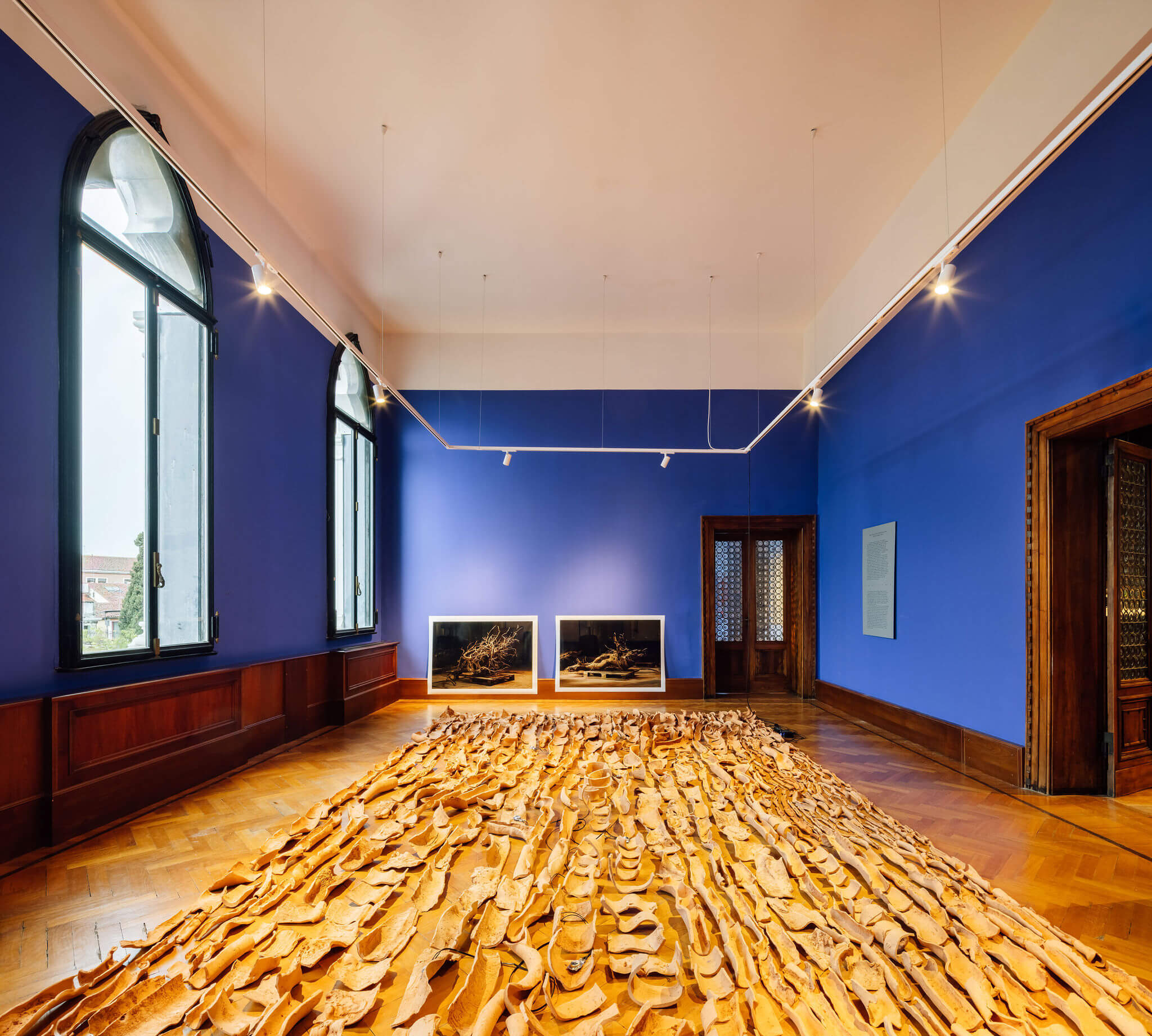
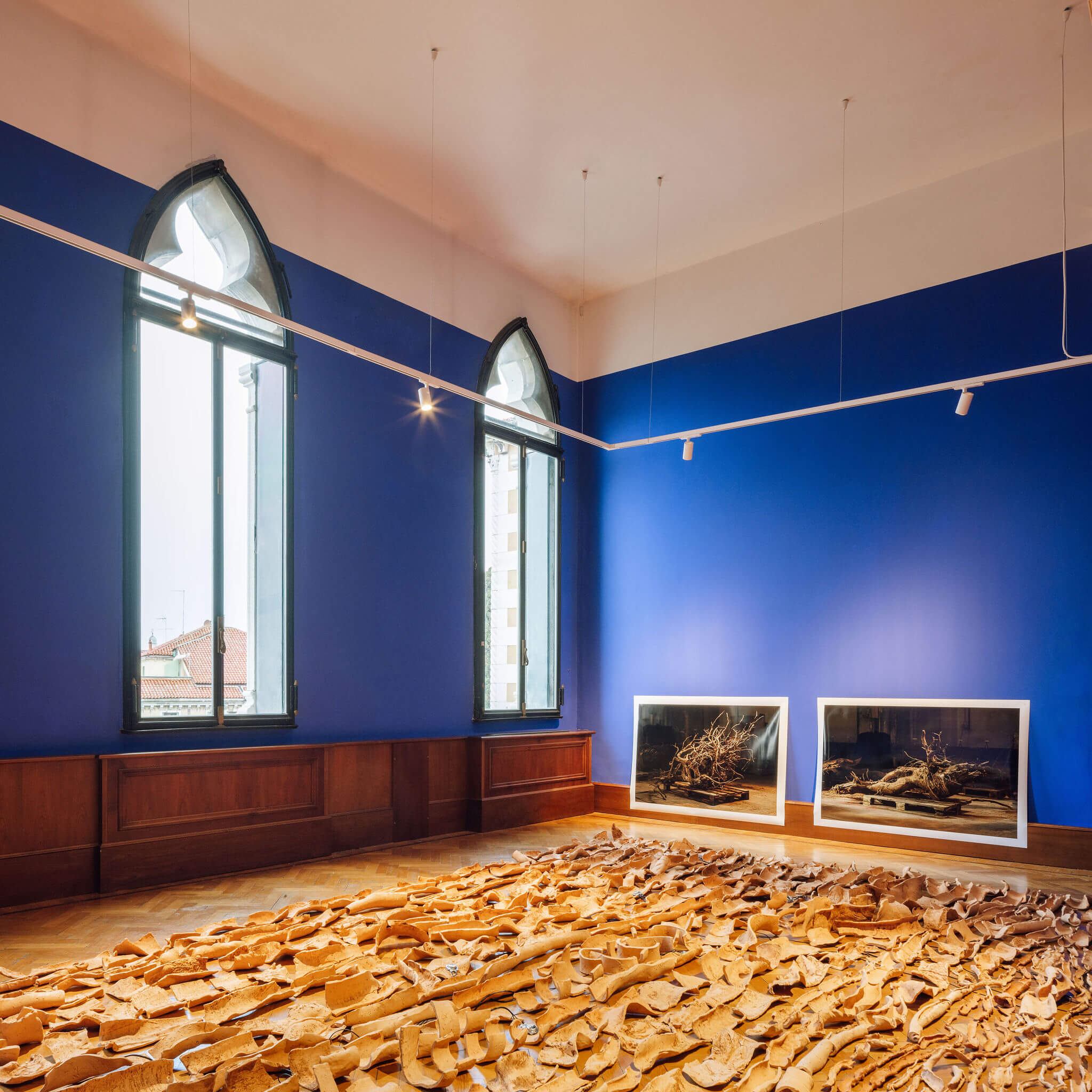
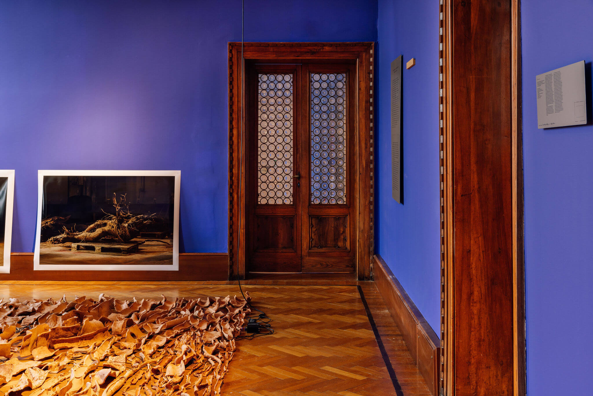
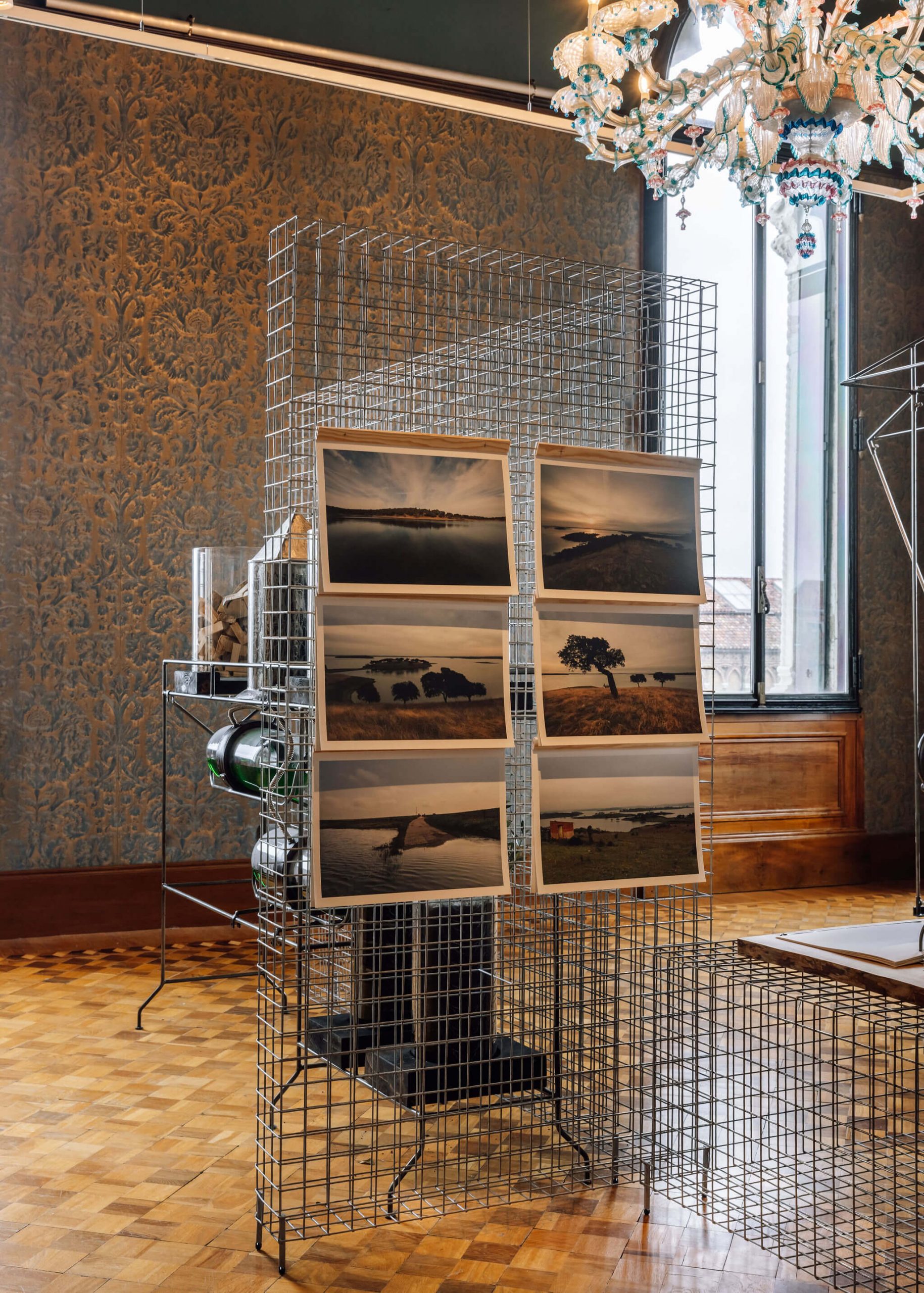
The investigation focuses on the upper reaches of the banks of the International Douro, a region emblematic of the relationship of dependency and sharing that exists between Portugal and Spain, and which underlines the relevance of water in soil and ecosystem conservation beyond its mere use as an energy source and an essential good for human consumption. As a way to combat the desertification of an increasingly depopulated area, we propose that ancestral techniques and natural systems be relearned, and that the symbolic dimension of natural elements be restored.
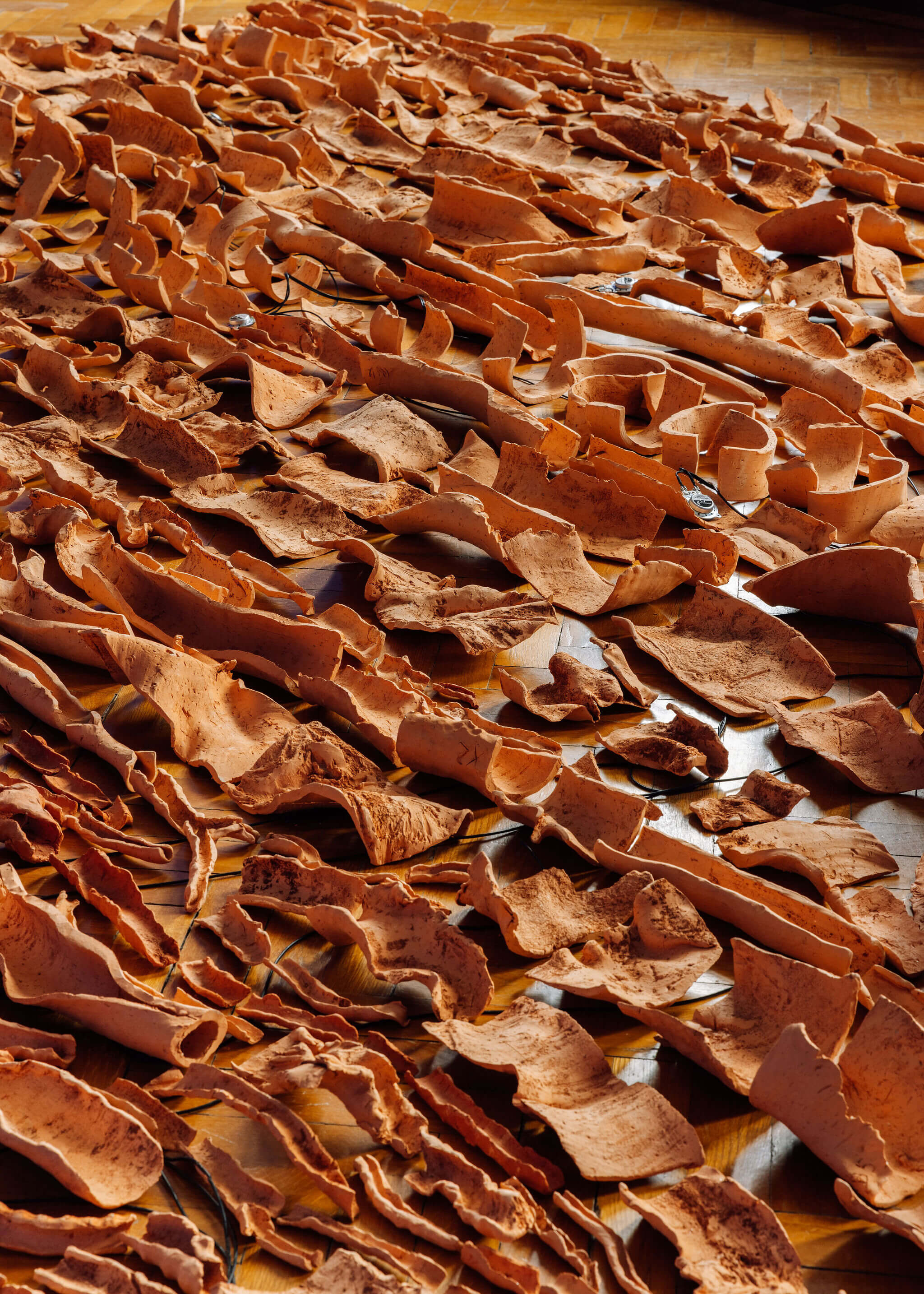
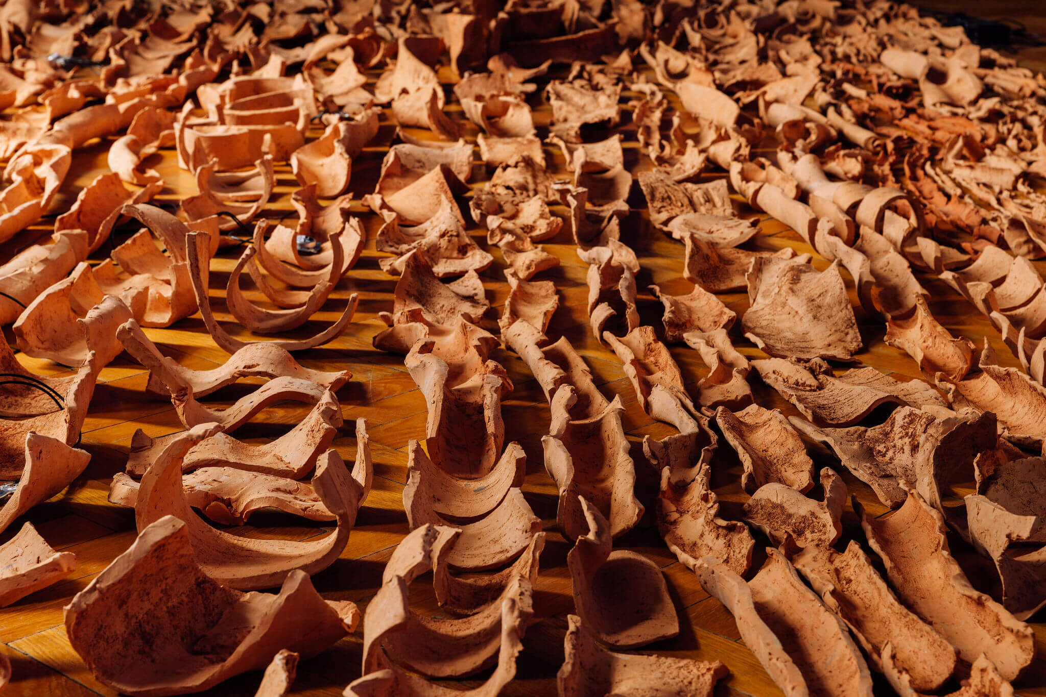
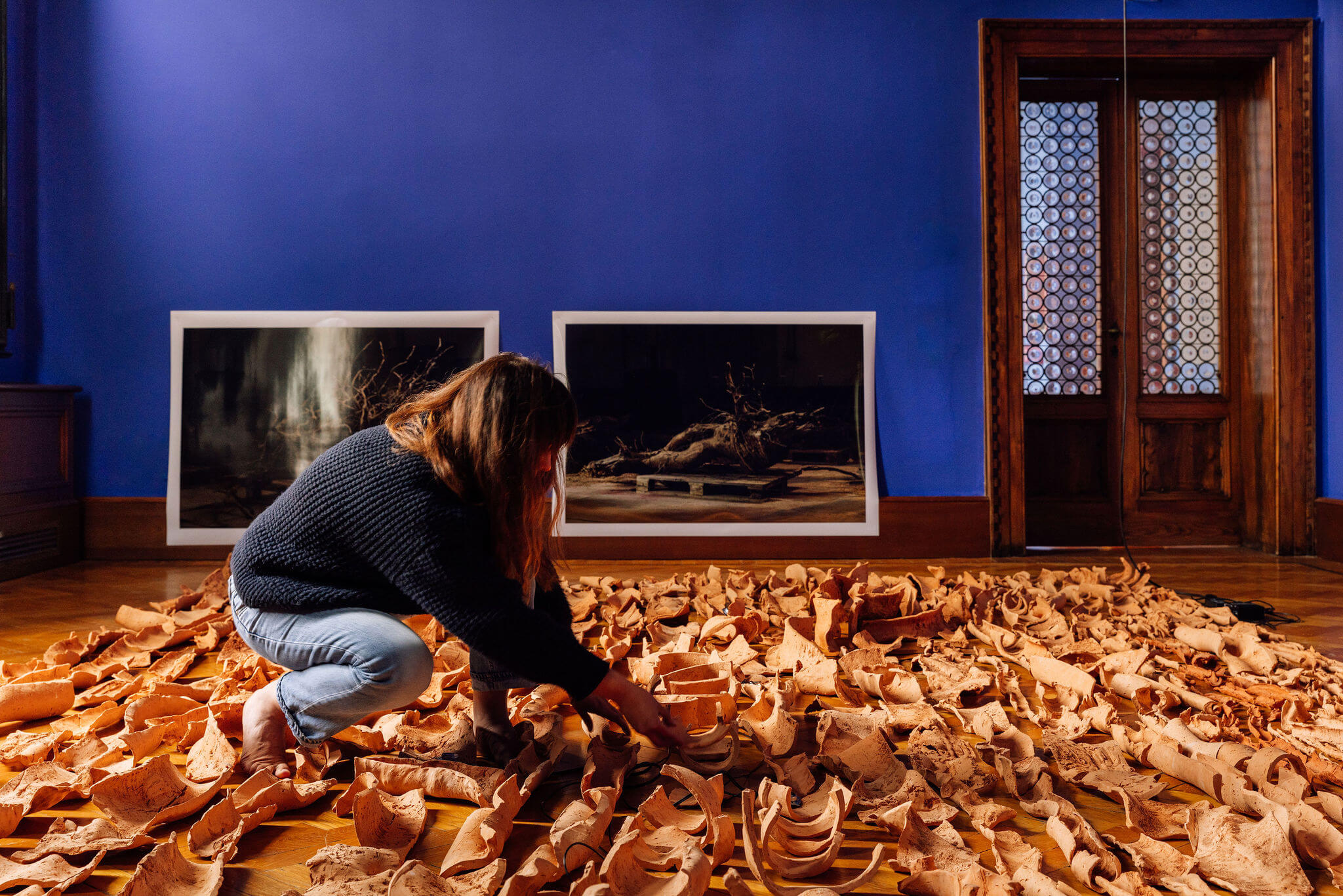
A vision for the preservation of fresh water is recounted through the roots of an ash tree, over which ceramic pieces have been shaped to reveal the invisible body of the ground, drawn here by means of a surrogate — a carpet of earth. The ground is the reservoir of the future, for water and life: a living, mineral and organic conceptacle where the roots of trees intertwine in a dialogue of complementary shapes which decelerate, spread and infiltrate the water. It is a complex and intelligent system, sponge-like in structure and in permanent flux, locally engineered and stemming from the forces of different cohabiting ecosystems in the struggle for food and reproduction of the species. The “ground as reservoir” is a lesson from International Douro to other places and serves as evidence that only local, shared and multidisciplinary knowledge can interpret and recognise the potential of a piece of ground, what it is made of and what it needs.
ACKNOWLEDGEMENTS Pedro Teiga, Maria Plantier, Pedro Russo, José Luís Machado Vale, José Carlos Pimenta Machado, Tentúgal Valente, António Jorge Jacoto, Lourenço Jacoto, Lázaro Fernandes, António Espinha Monteiro, António Bárbolo Alves, Nuno Jorge Rodrigues Gonçalves, Jorge Duarte, António Fernandes, José Cunha, Miguel Ferraz, Stijn Coppieters, Hugo Aguiar dos Santos, Joana Vicente, António Frade, Bruno Morais, Serafim Correia, Serafim dos Anjos, Atanásio dos Anjos, Eurico Almeida, Carlos Silva, Conceição Meirinho, Joana Felício, António Borges, Vitor Dias, Pedro Jervell, João Roquette, Rui Falcão, Regina Barroso, Susana Fernandes, Francisco Antão, Sérgio Coutinho, João Miguel Ferreira

Authors:
Dulcineia Neves dos Santos, Frederico Moncada, Georges Lieben, Ivana Sehic
Soundscape:
Lendl Barcelos
Photograph:
Miguel Fernandes
Awash is the name of the soundscape that accompanies the movement of our body through space. Taking advantage of the array of vibrations that are intrinsic to the molecular structure of each piece of clay, the piece conjures the constantly changing sonic spectrum of the water lines.
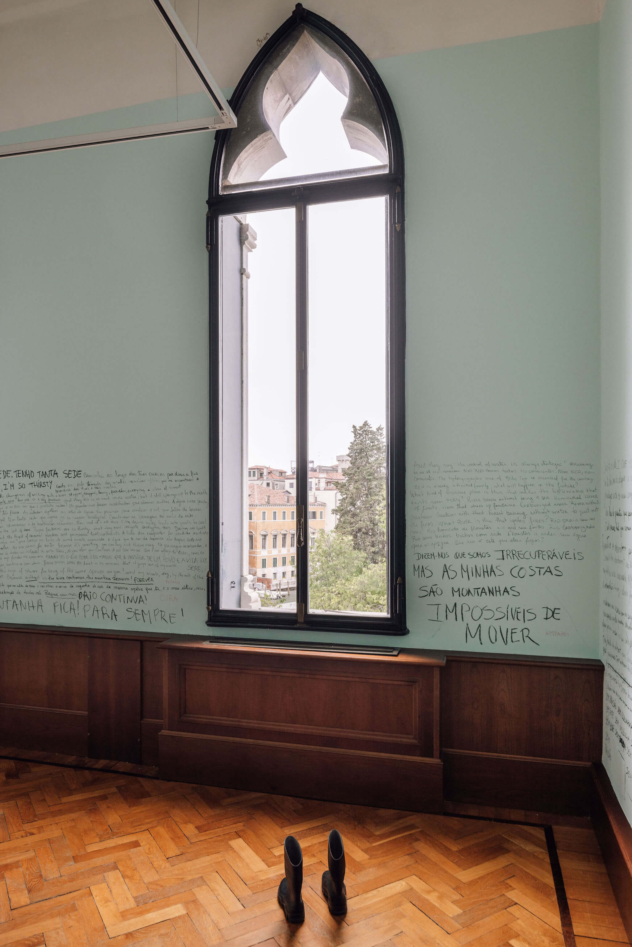
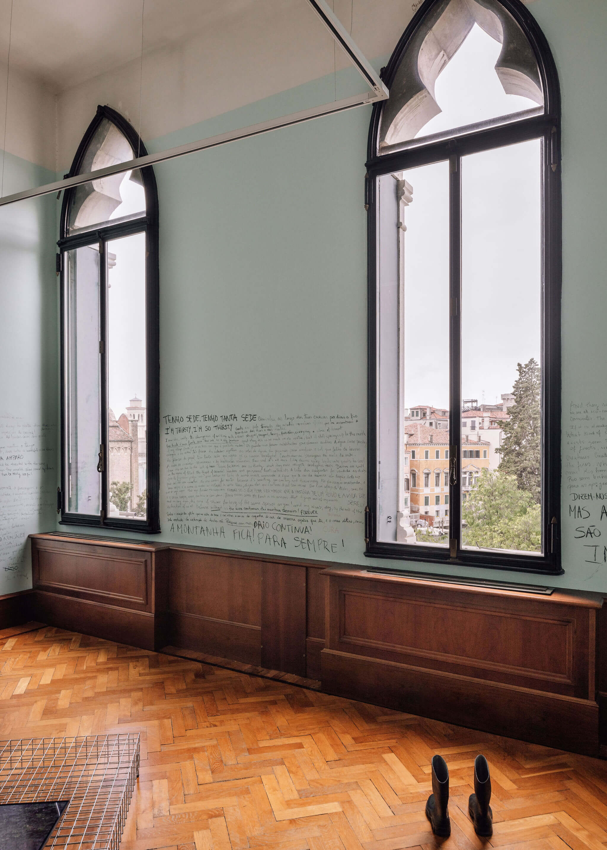
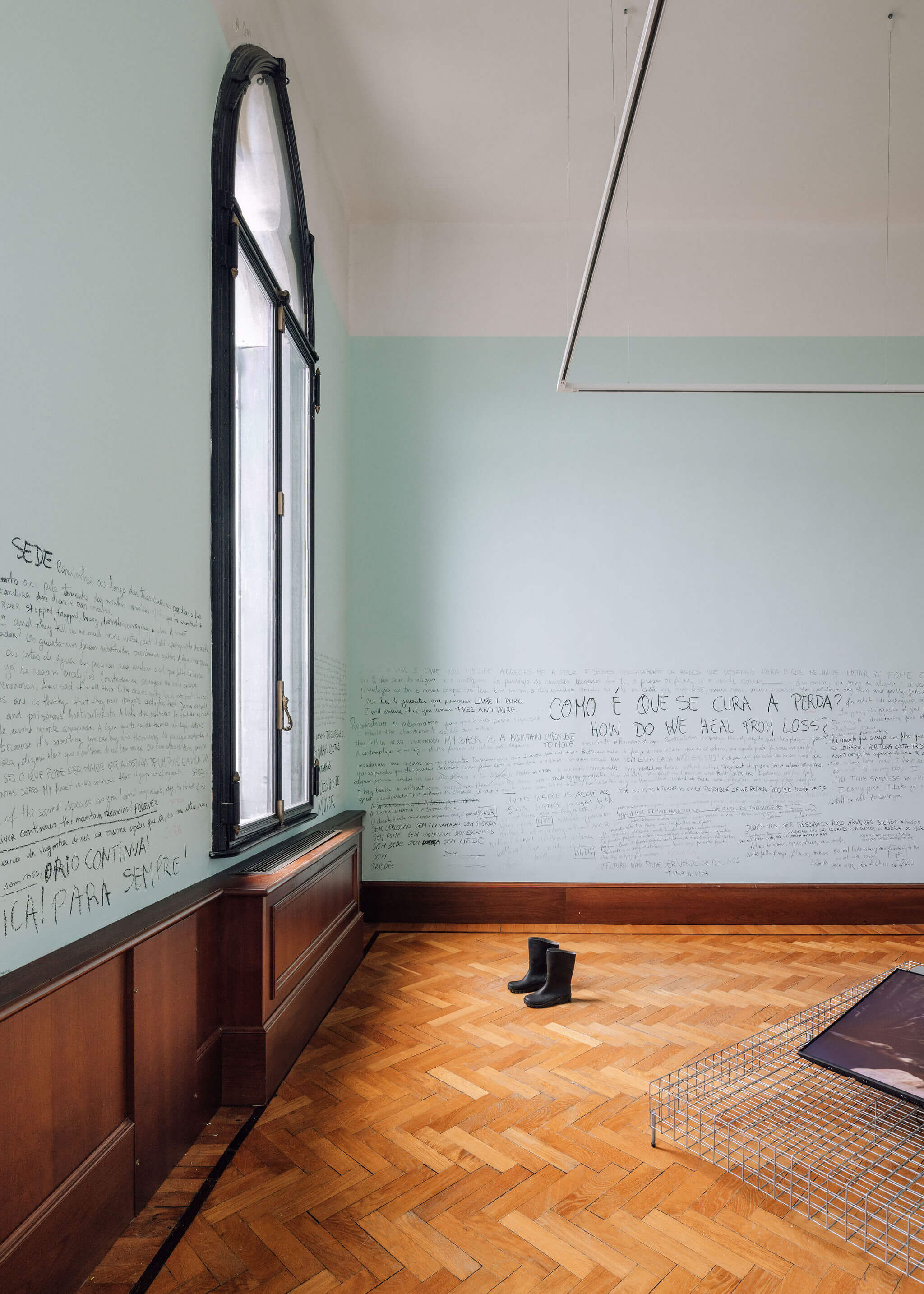
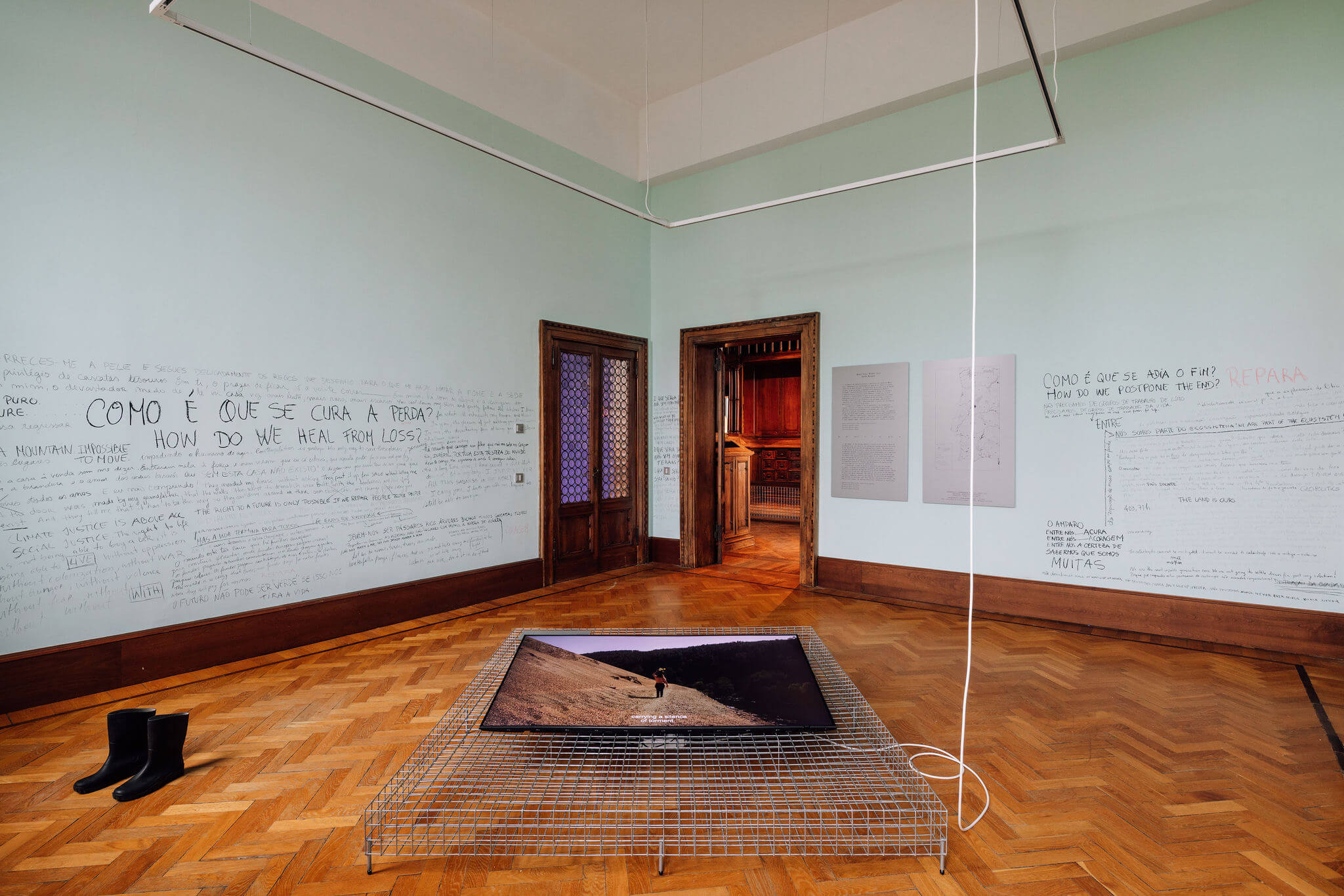
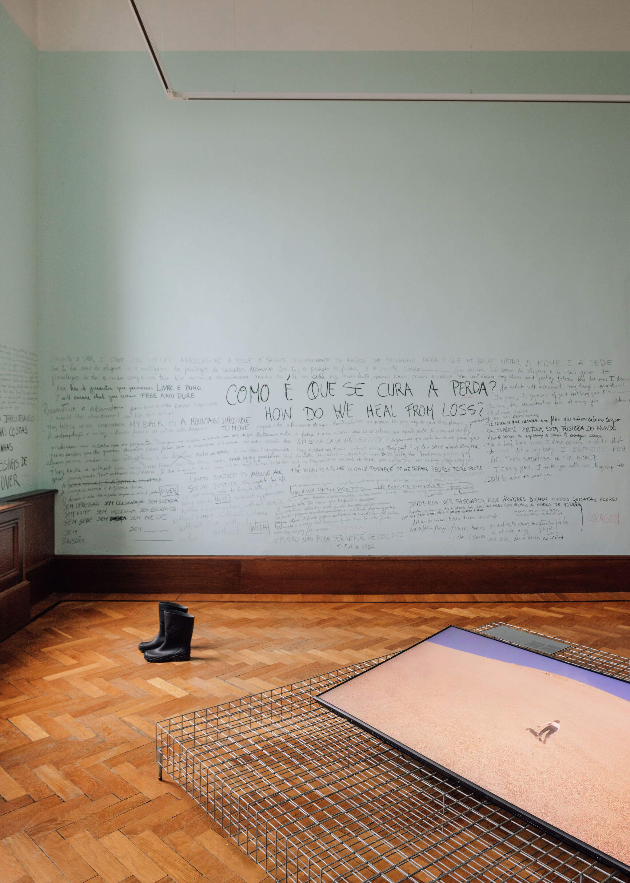
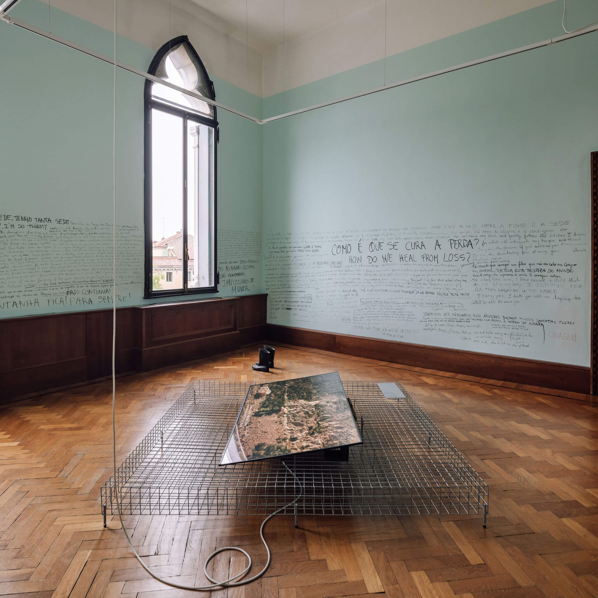
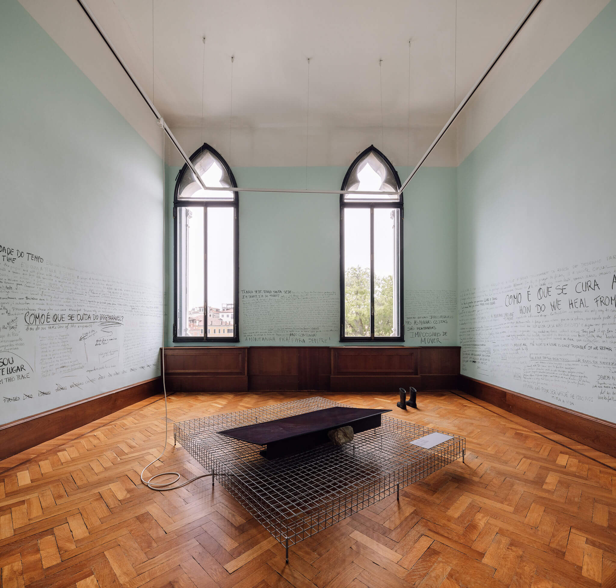
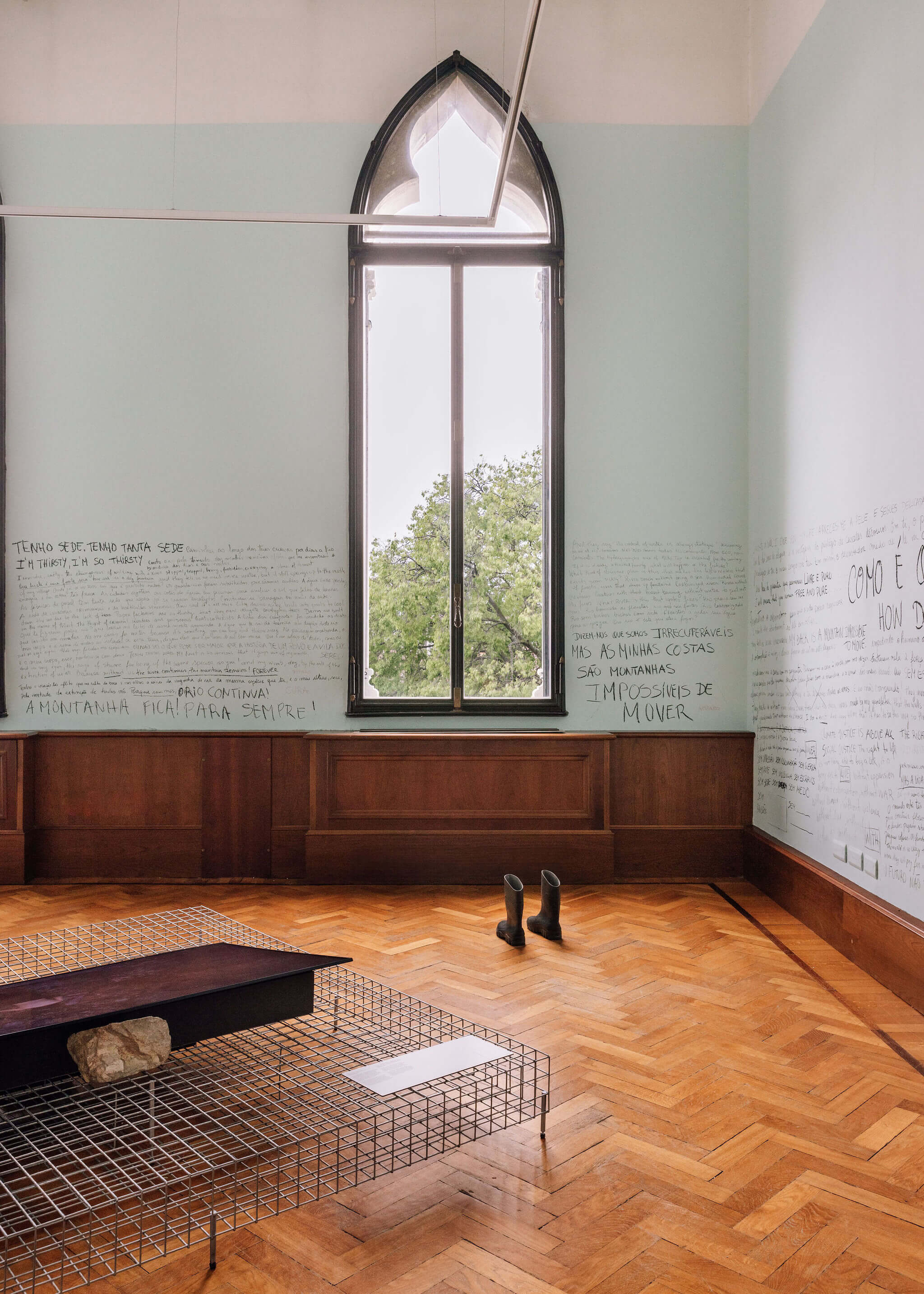
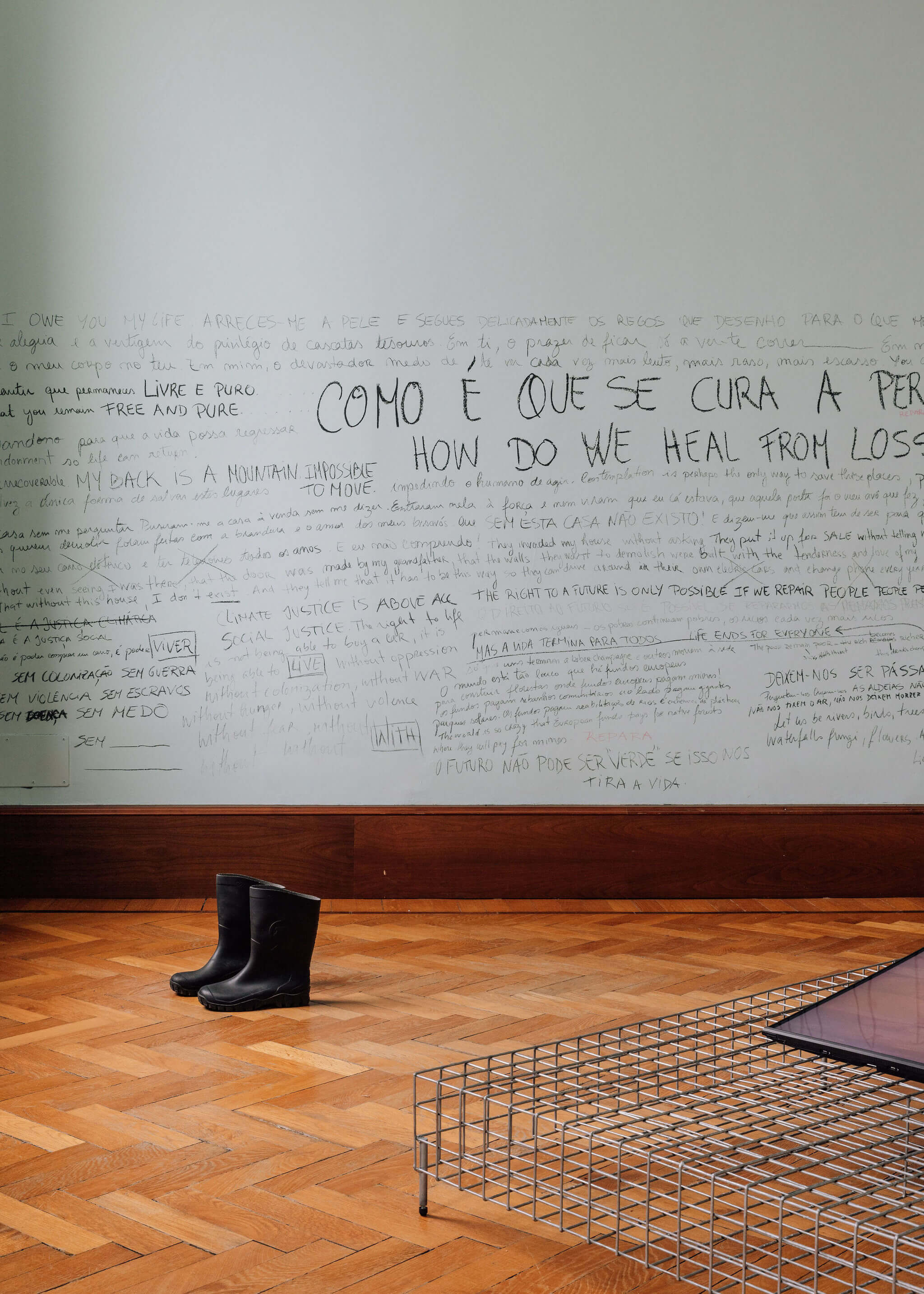

The impact of the mining industry is plain to see in the region of the Middle Tejo, not least in the widespread contamination of the water in the Zêzere River and the surrounding water tables. The detection of high levels of heavy metals, above the World Health Organisation’s recommended maximum, is a particularly grave development at a time when a proposed transfer is being considered to increase the flow of the Tejo River, thus guaranteeing water supply to the Lisbon metropolitan area. Rethinking the policies and priorities of extractivism, the proposal advocates the progressive renaturalisation of the landscape, in a manifest process of recovery and decontamination, based on the political and activist tools of architecture.
Architecture is done by means of manifestos and the courage to repair. A strong relationship of proximity and intimacy with the territory is expressed through the written and performed records, which are sensitive to the past and concerned for the future in the urgency of such a new world endeavour. The sharing strives to unite mechanisms and shapes, memories, concerns and anguish, to sensitise the thought and the body of those who read, hear and see: the word also builds, the body is also a place. By sharing sensitivity, affection is reactivated.
Stop and stop again, so that repair can be possible.
We need to repair the Zêzere.
We need to repair the water.
We need to repair the world.
ACKNOWLEDGEMENTS Miguel C. Tavares, GPSA – Preservação da Serra da Argemela, ProTEJO – Movimento Pelo Tejo

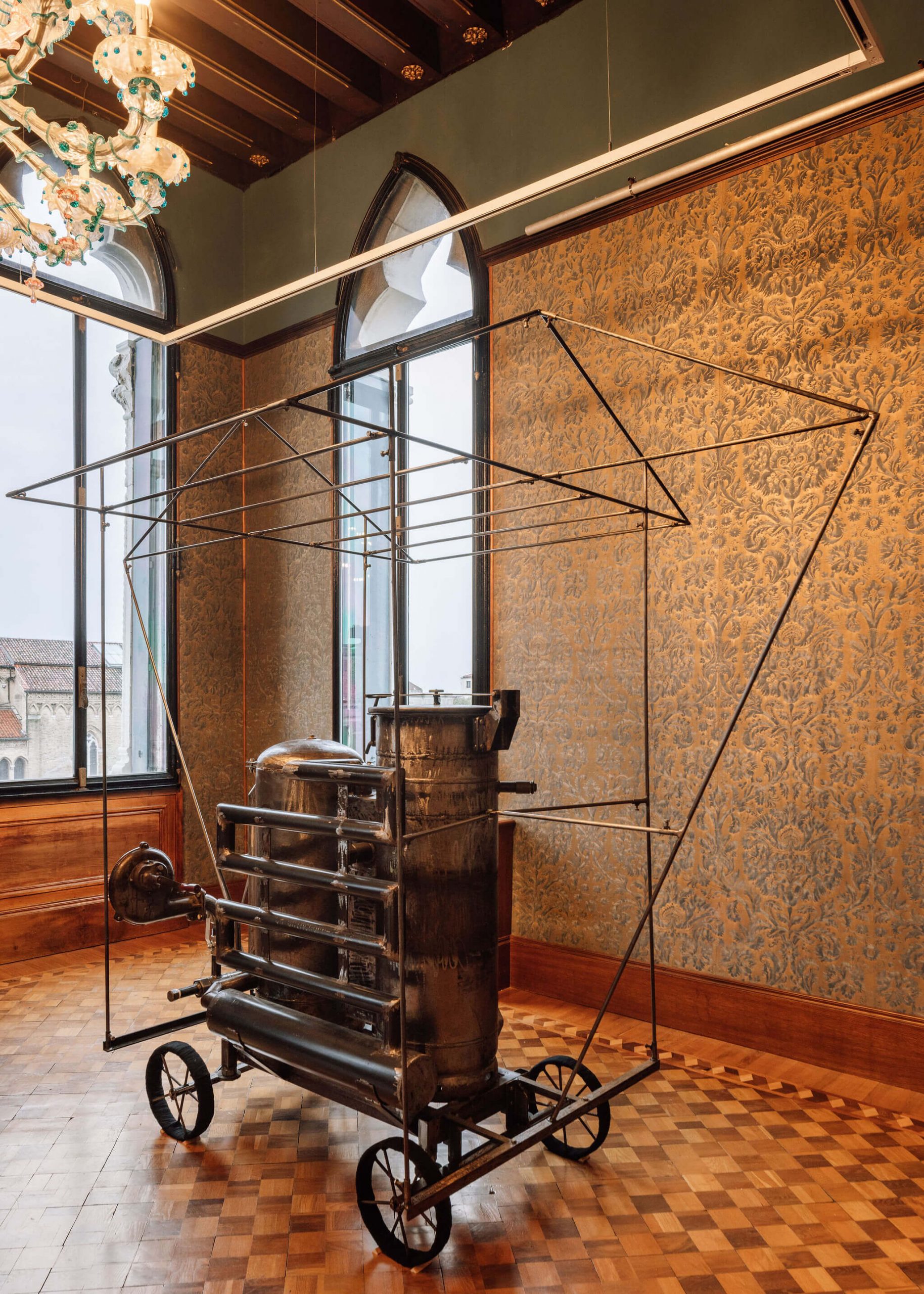
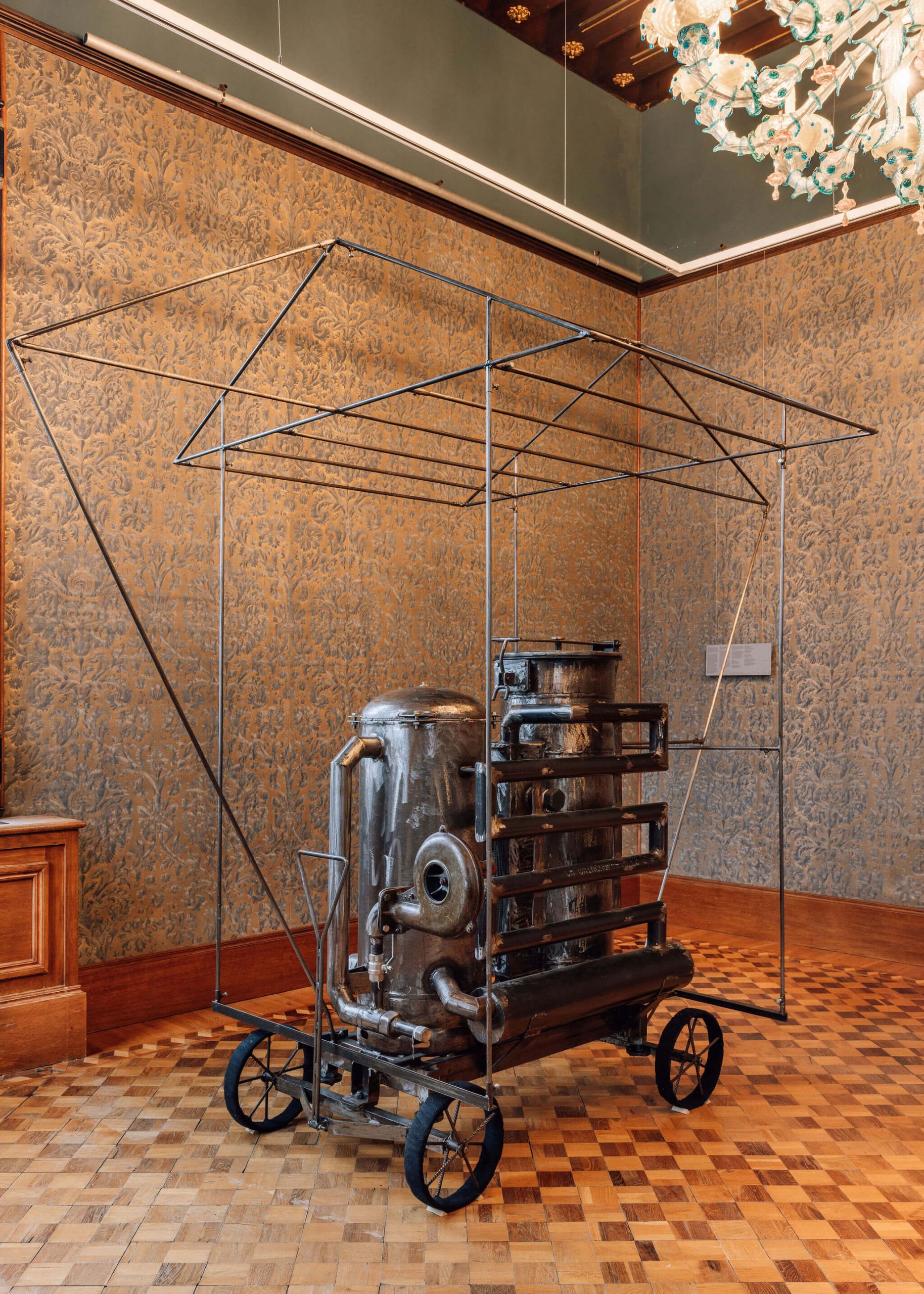
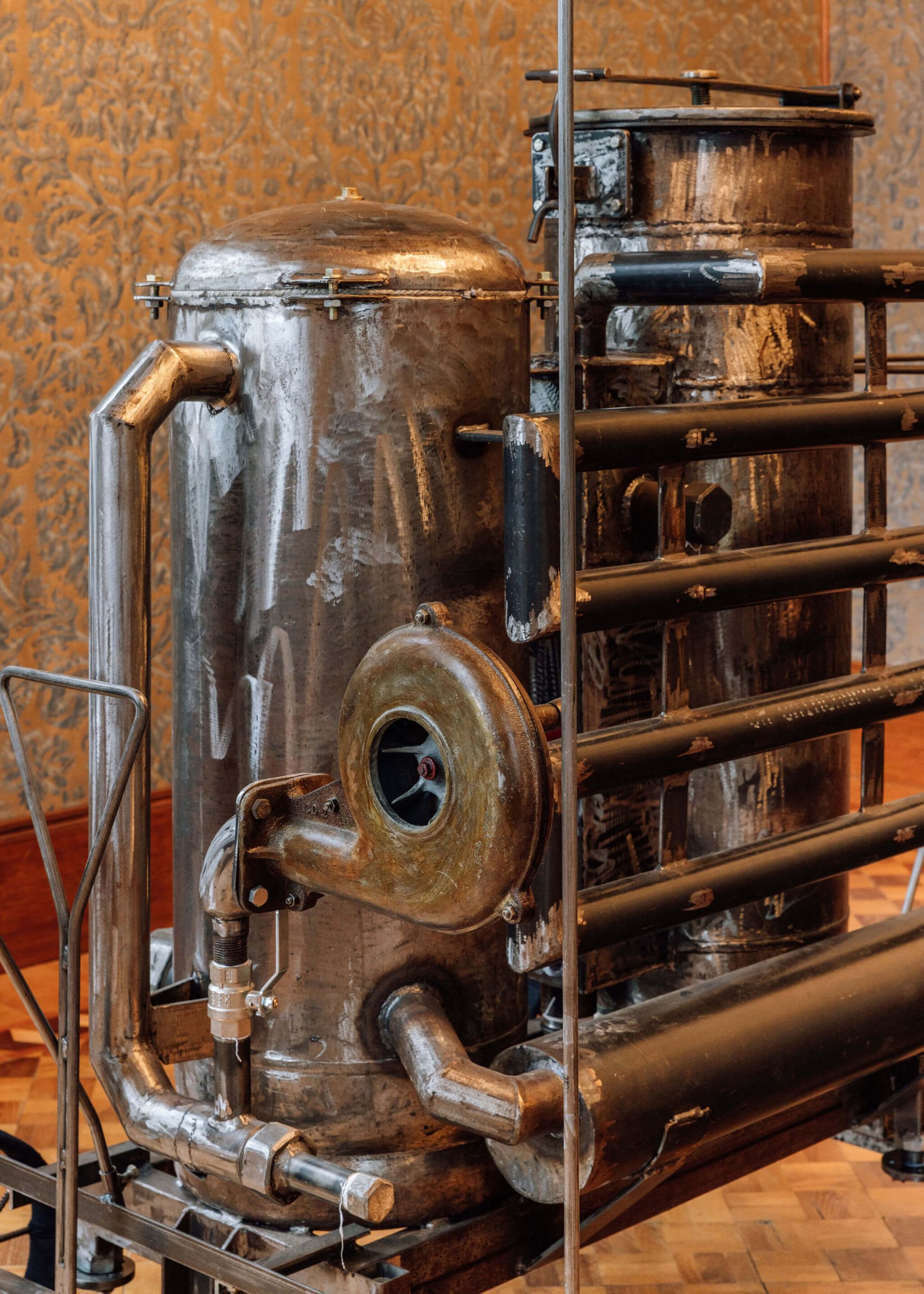
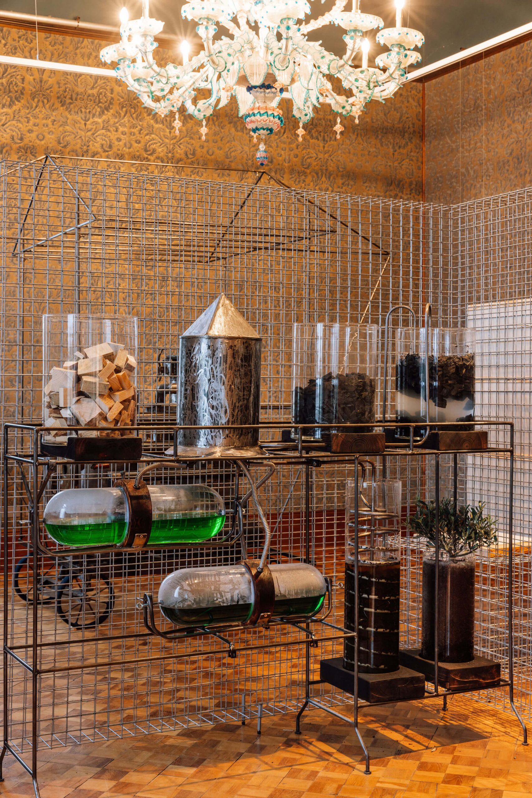


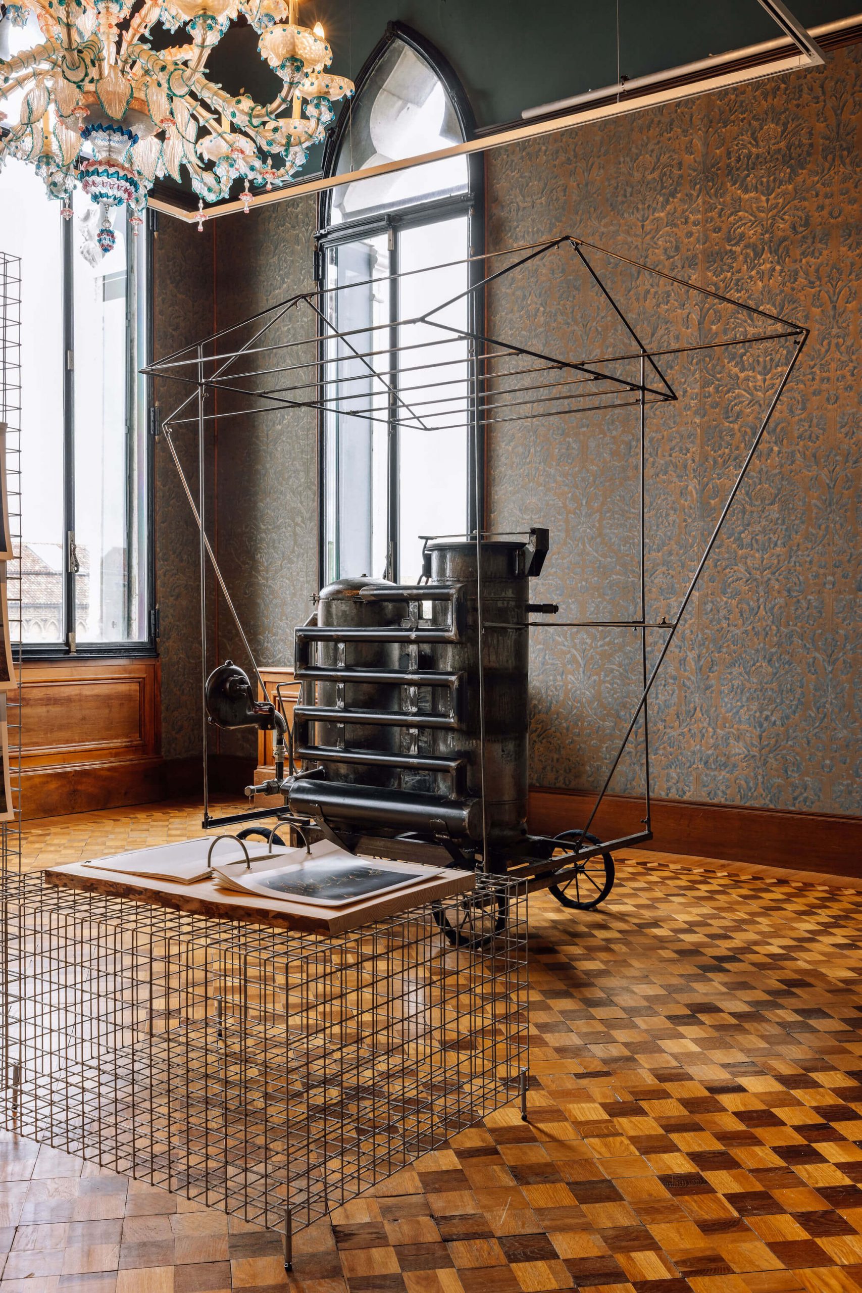
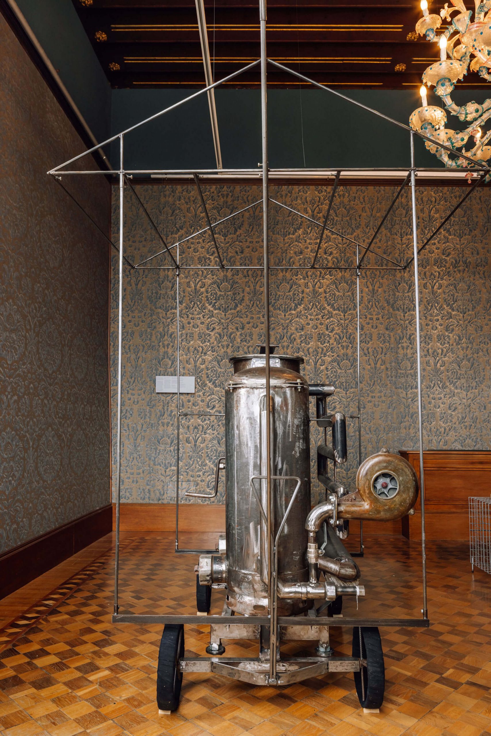


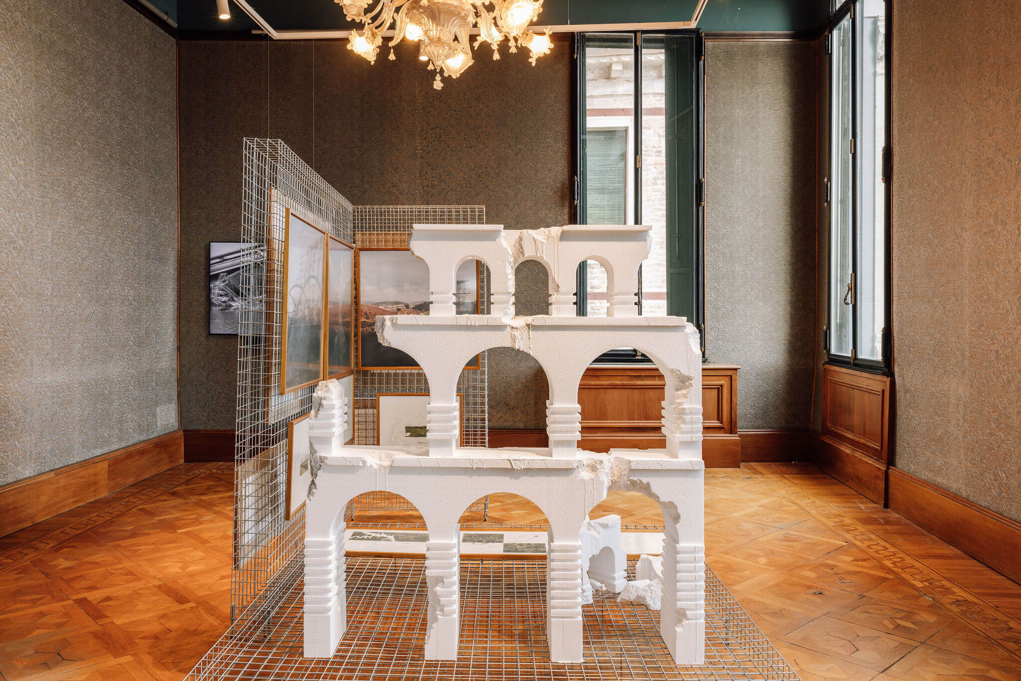
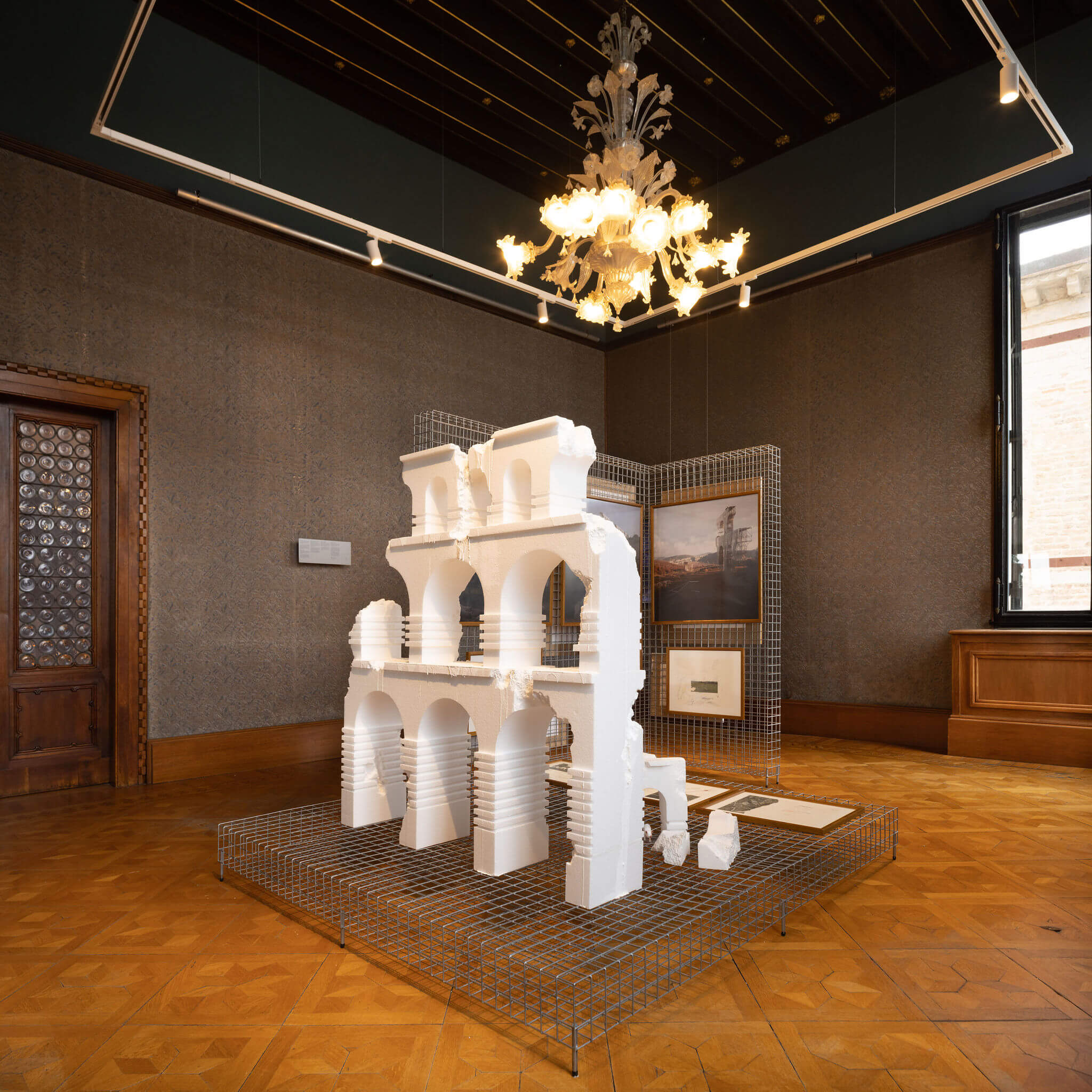
Presented in the political sphere as a textbook case, the Alqueva Reservoir is responsible for the extreme transformation of a landscape – be it dryland or irrigated – by the creation of the largest artificial lake in Europe. Its water enables emergent energy needs to be met, stimulates tourism and, above all, contributes to the high levels of productivity in the incumbent agrobusiness, which is simultaneously responsible for the contamination and over-exploitation of the soil. By working on the consequences of this change and being attentive to its impact on the diversity of ecosystems, state structures and social inequality, the proposal explores the operational and technical dimension of architecture in the development of decontamination and soil production mechanisms and in a forecast of the future of the region.
Fictionally, a near future is staged in which the Alqueva reservoir has ceased to exist, giving way instead to a clay pan surrounded by a forest abundant with unique characteristics: a vegetation mantle formed by a tissue of circular pouches of vegetation capable of holding quantities of water equivalent to what once existed in the lake. Artefact for the regeneration of the soil is an invention constructed in steel by Pedrêz that, through the use of agro-industry waste transformed into thermal energy, hydrogen and coal, enables the purification of water and the production of biofertiliser. This robust response of social and environmental regeneratio by means of the simple and enduring actions of humans in the landscape, repositions them as conscious elements and generators of fertility.
ACKNOWLEDGEMENTS Augusto Silva, Julia Santalla, Lara Jacinto, Ben Peterson

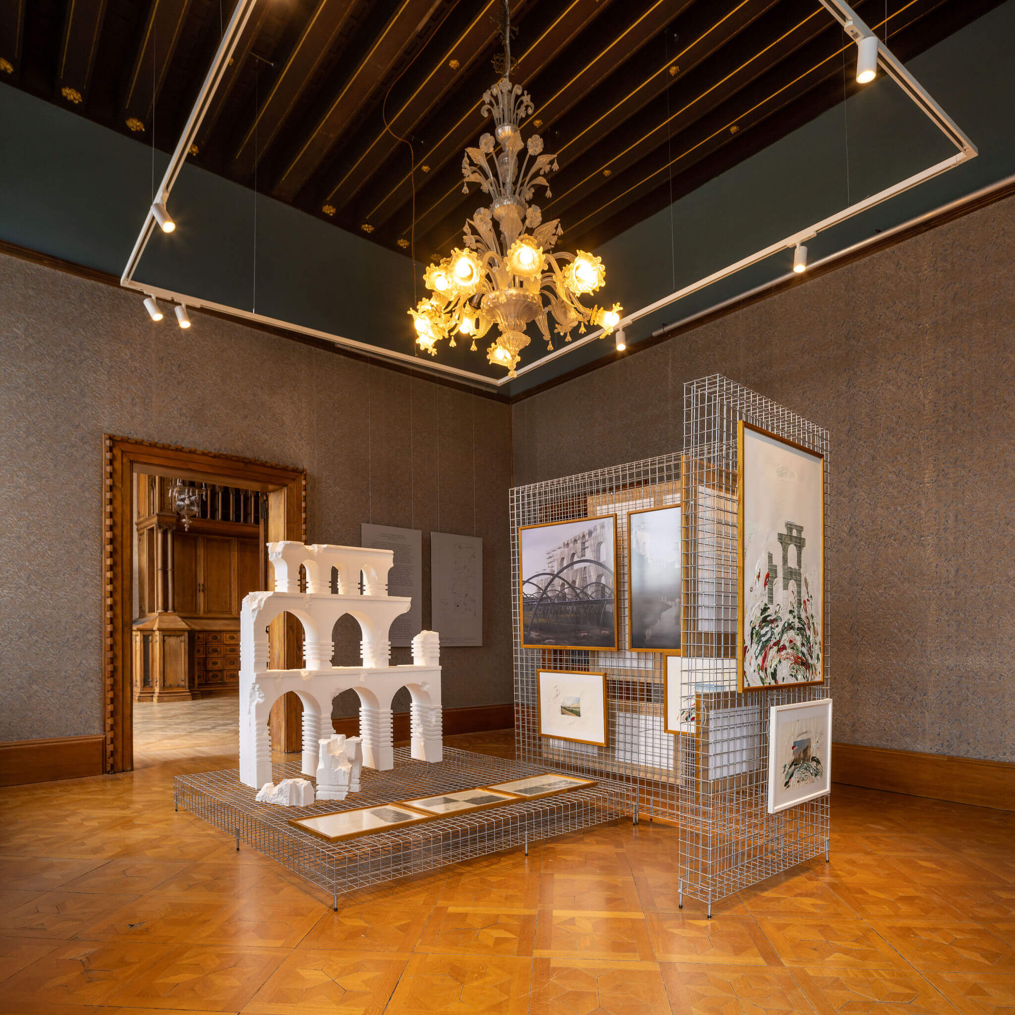
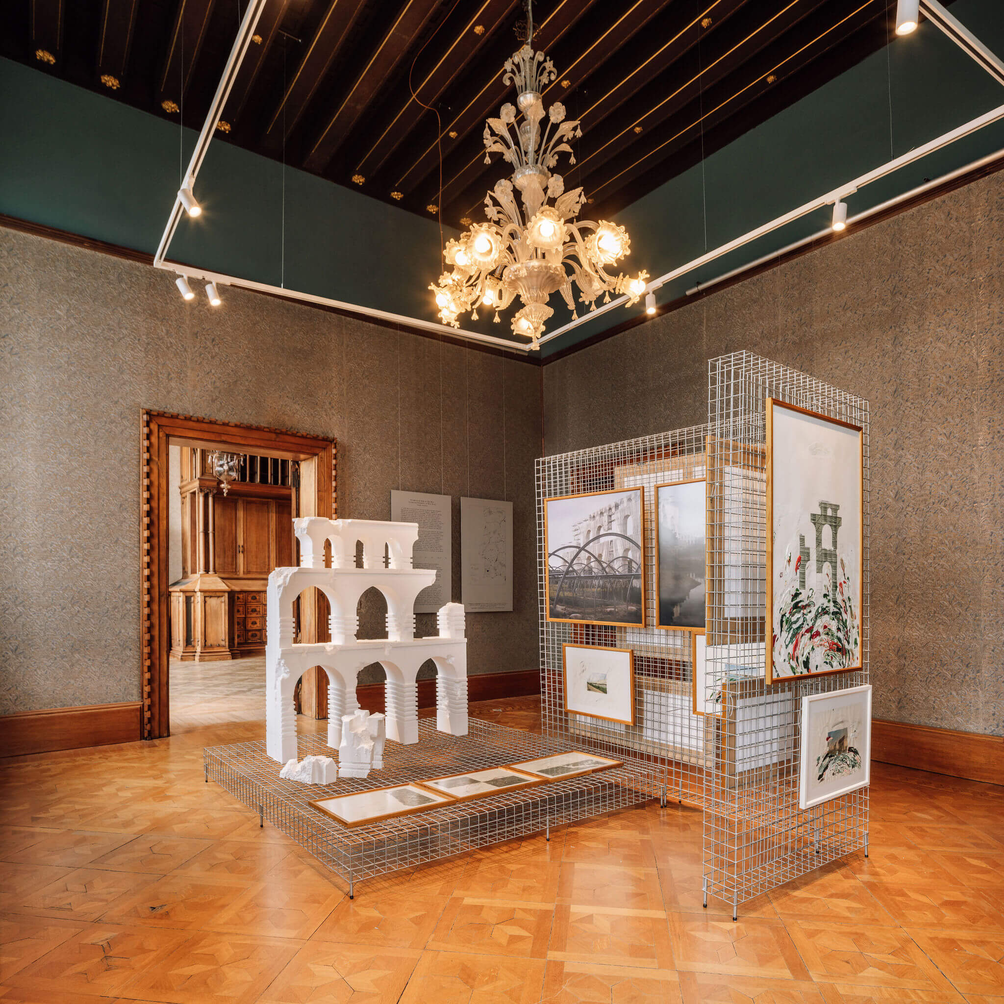
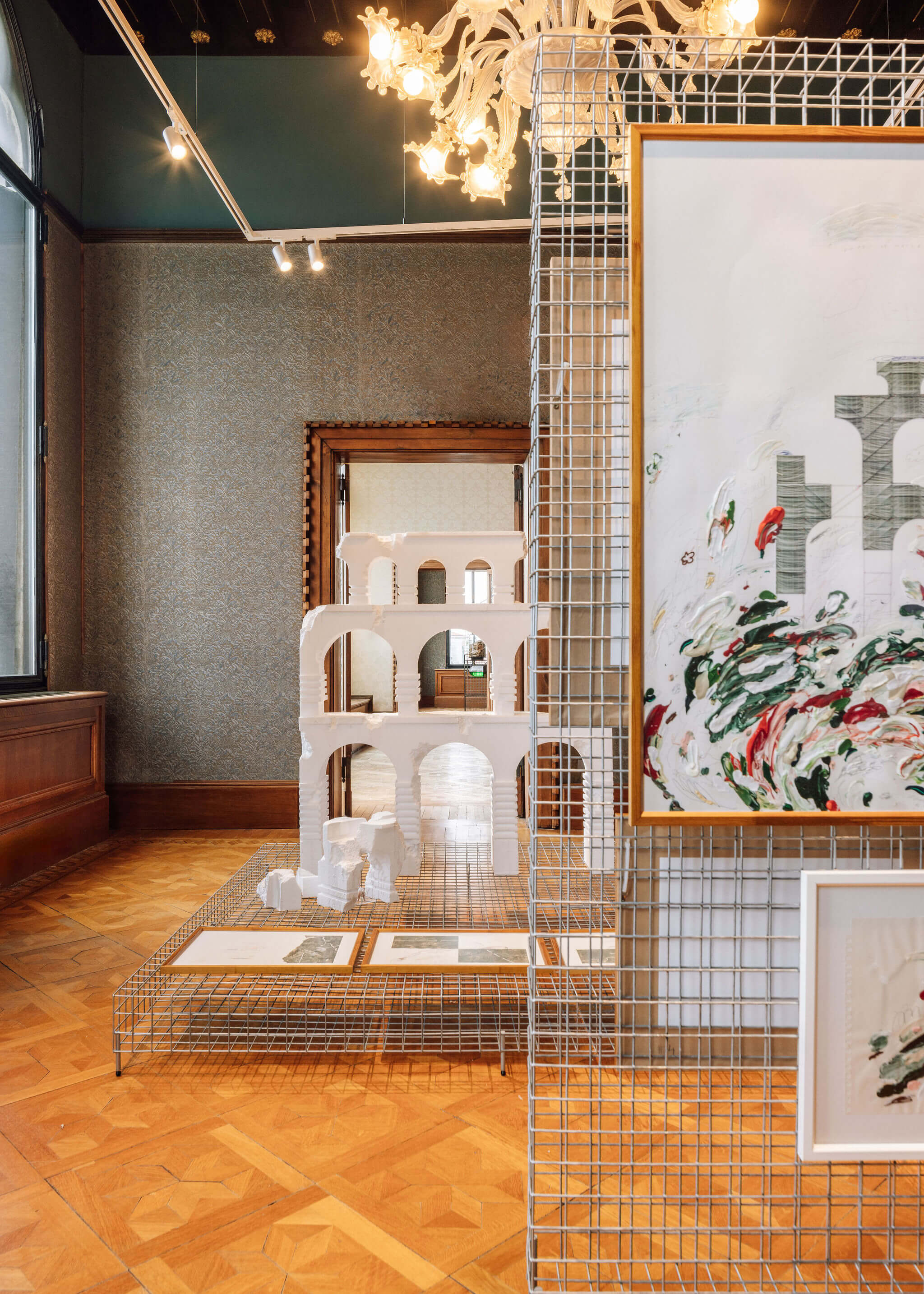
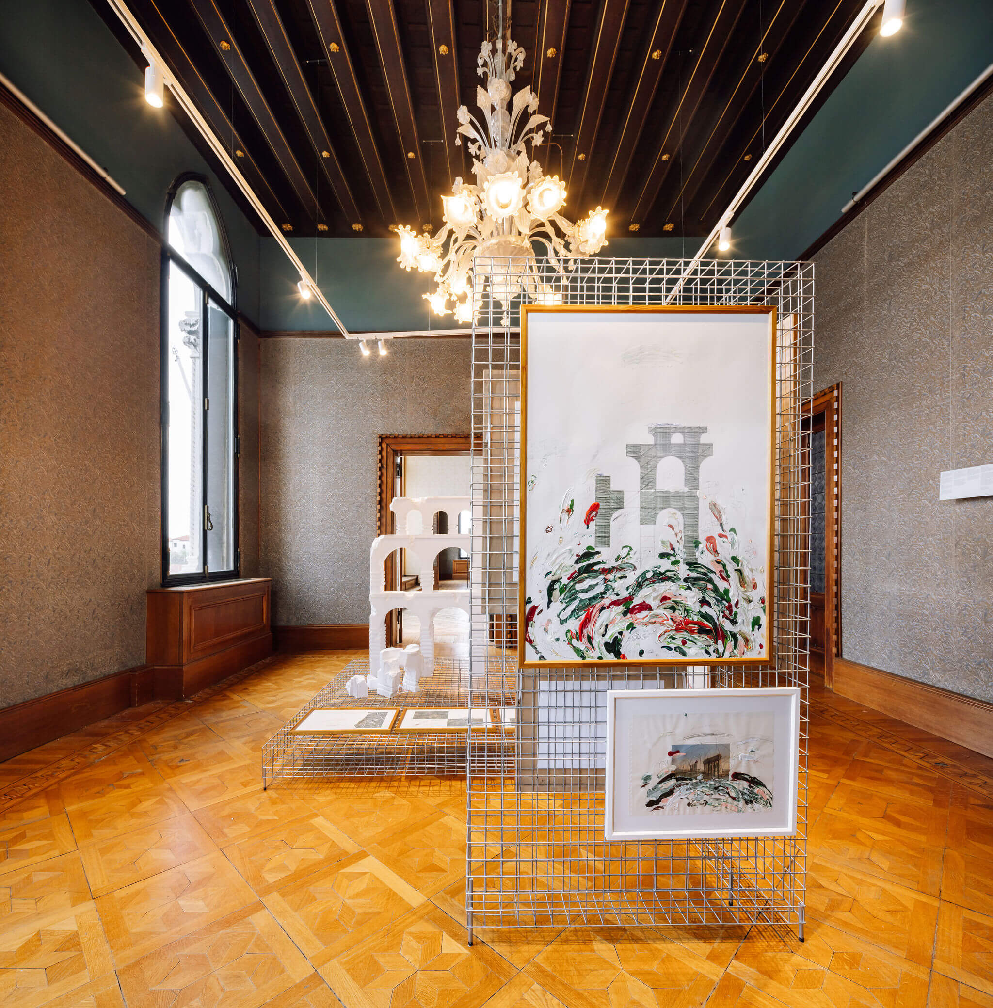
The Mira River is surrounded by a wide irrigation perimeter currently dominated by exogenous investments and interests, imposed on established farming models of smaller scale or ambition. Taking advantage of pre-existing networks, high-yield farms contribute to unequal access to water resources, as well as to soil and water contamination through the use of accelerating agrochemicals. At the same time, its viability is based on the super-exploitation of immigrant workers, hidden agents, subject to precarious working and housing conditions. The proposal advocates the political potential of architecture, based on the denouncing of situations of exploitation and superimposition, alerting to the lack of regulation of this system.
Accepting Architecture’s inability to find a solution to the complexity of this problem, a denouncement installation is proposed, which, owing to its poetic dimension, intends to raise global awareness of social, ecological, administrative and economic issues under debate. As a symbol of the desirably democratic distribution of water throughout the territory and the population that inhabits it, the aqueduct, once incomplete, broken and fragmented, highlights its own dysfunctionality and purposelessness. This mobilising object aims to clarify the problematic matrix of access to water in these landscapes, imagining three distinct moments: next to the Santa Clara dam; in a natural and undefined territory; and near the mouth of the Mira River, where most of the high-yield farms are concentrated.
ACKNOWLEDGEMENTS Okdraw, Francisco Janes, Câmara Municipal de Faro

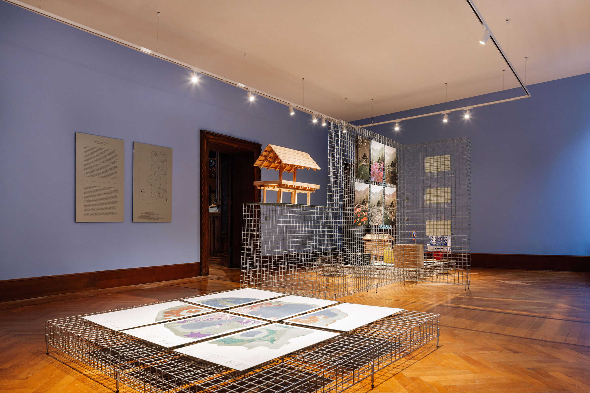
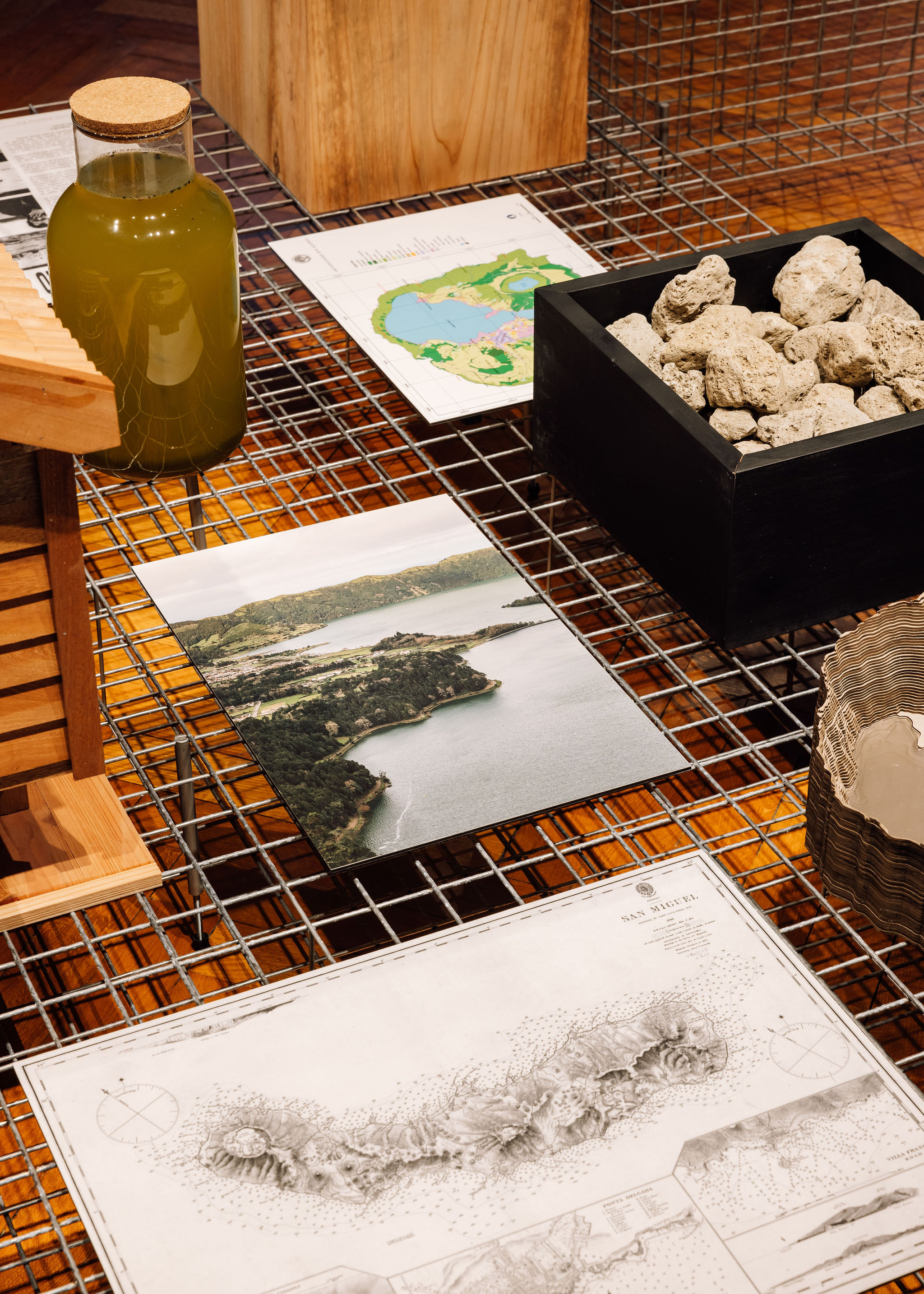
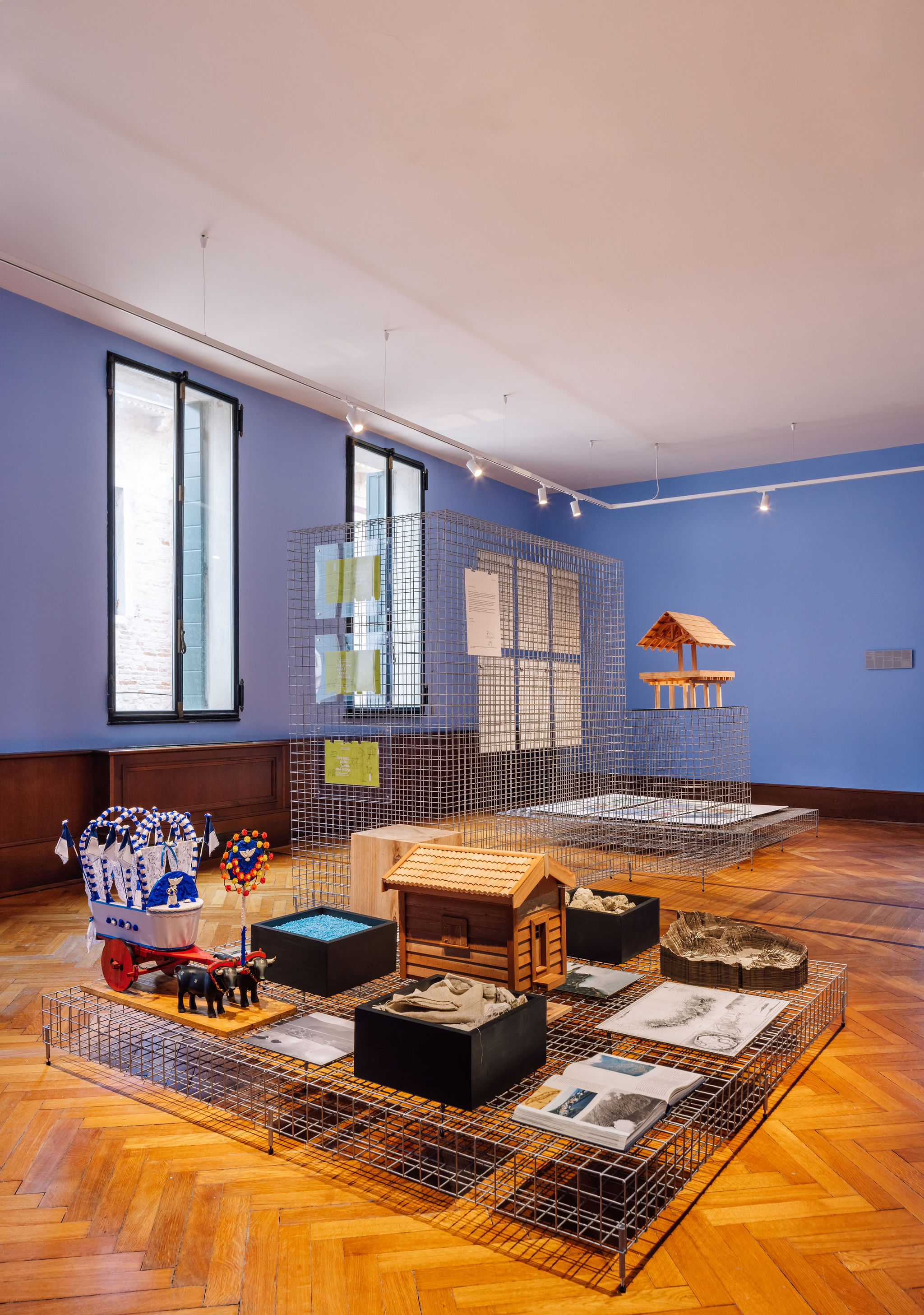
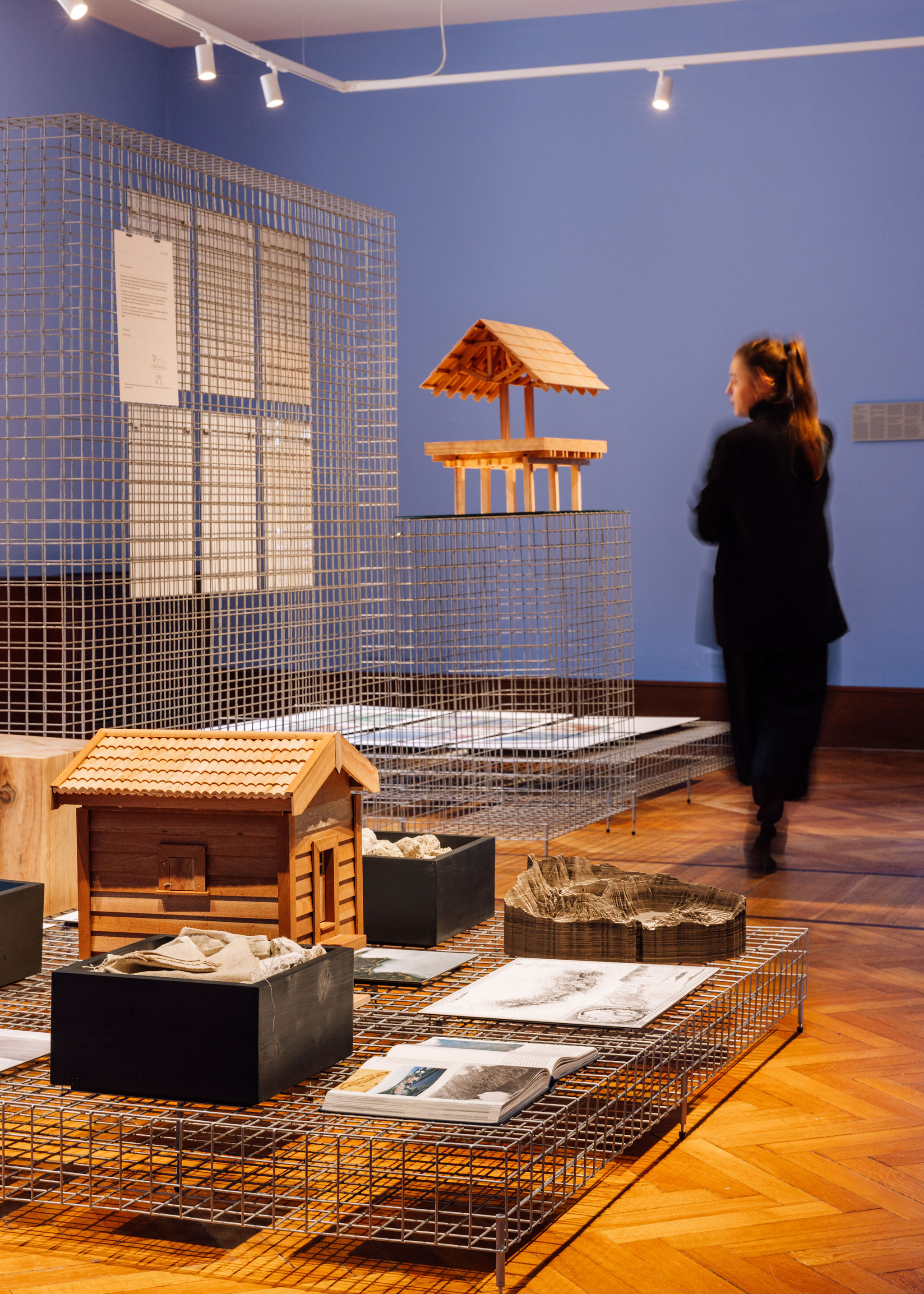
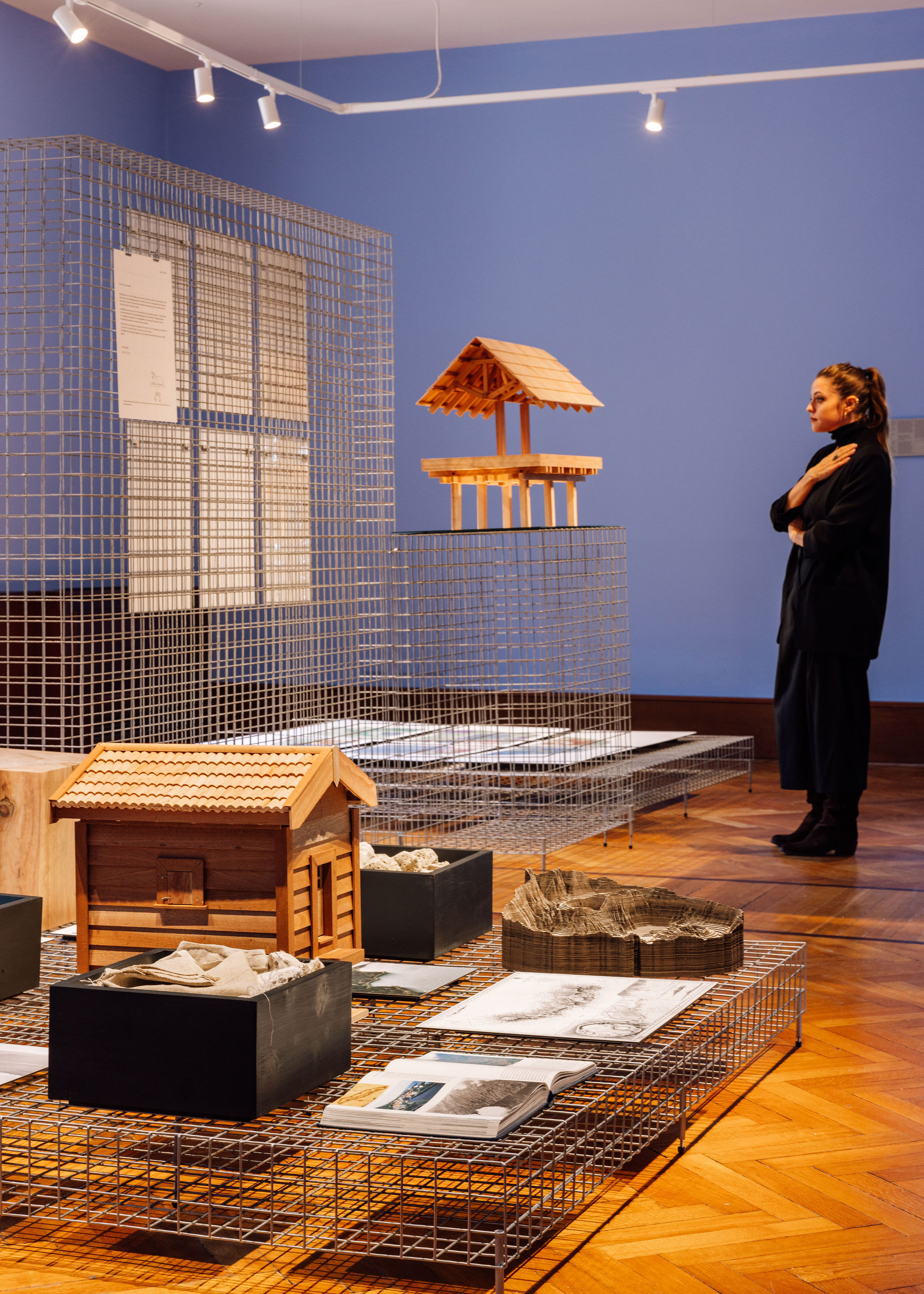
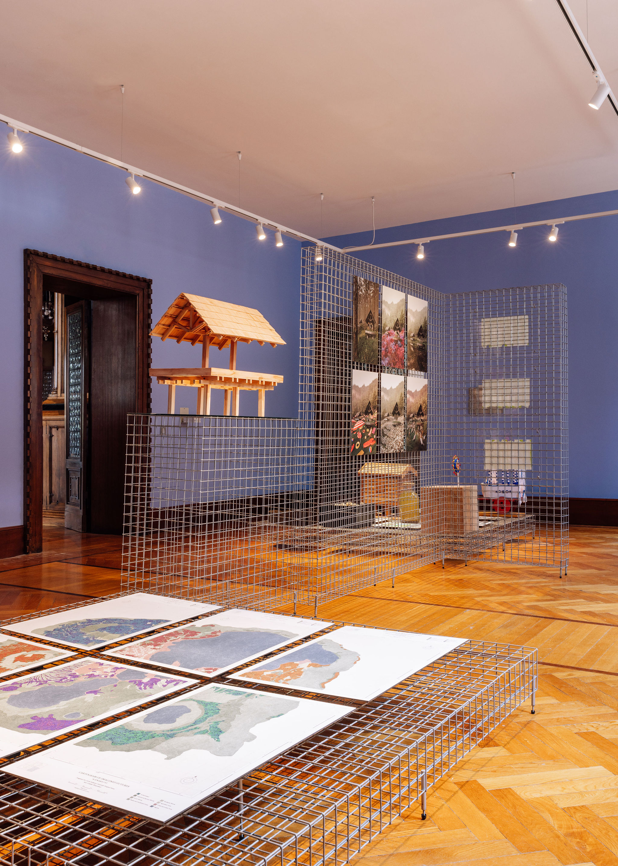
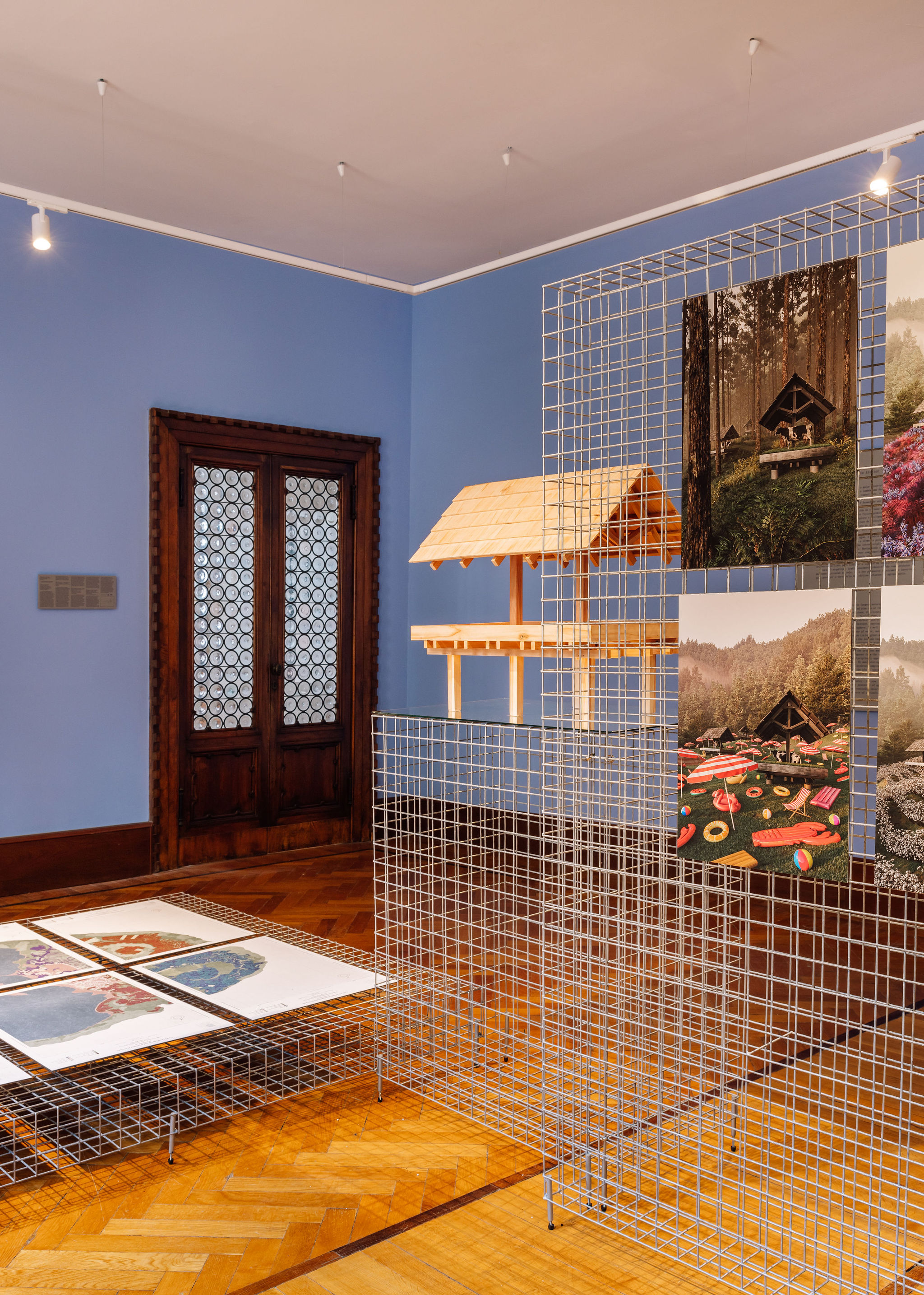
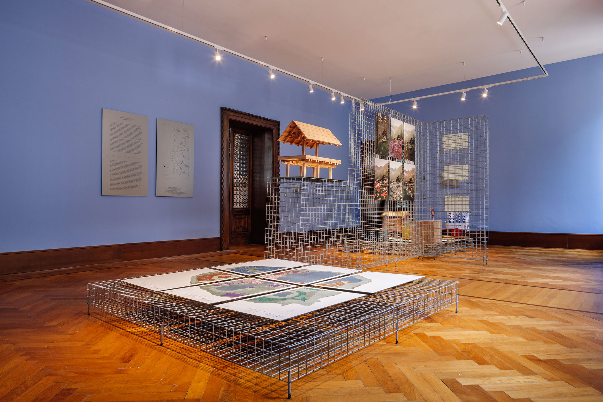
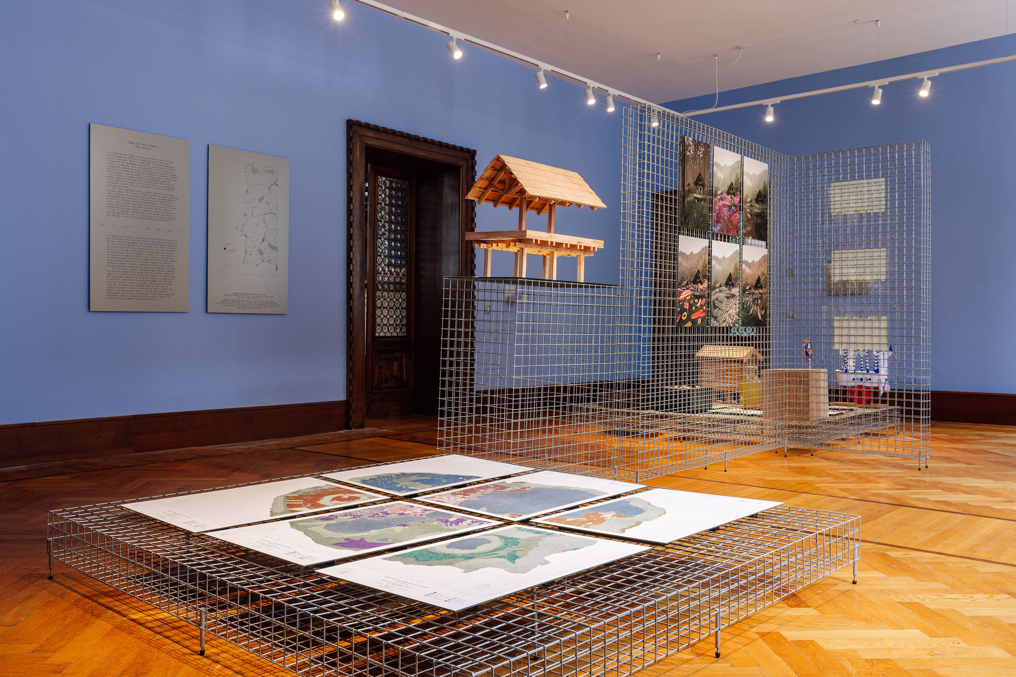
Lagoa das Sete Cidades is the largest natural freshwater reservoir in the archipelago of the Azores, and also one of the seven natural wonders of Portugal. Despite being romanticised, the livestock farming is responsible for the accelerated degradation of ecosystems in the basin’s territory and in the water of the lakes. Excessive use of fertilisers for pastures gives rise to eutrophication processes, causing significant emissions of carbon dioxide into the atmosphere, as well as the deterioration of the bio-physical-chemical balance of water, making its use unfeasible. The proposal explores the utopian (re)imagination of the region, fighting the main source of pollution in the Azorean lagoons, by critically rethinking land use, in direct conjunction with the social, cultural, heritage and natural dimensions that define the landscape of the Azores.
To restore water quality, the proposed model considers removing the polluting element of the lagoons from the territory, weighing all impacts in a coordinated interdisciplinary approach, in order to ensure more sustainable opportunities. By manipulating the (in)tangibilities of the future, the different discourses complement each other and contribute to other visions of the place, speculating on fictional scenarios. The granary, a recognised element of the vernacular architecture of Sete Cidades, is taken out of context to house the symbol of the agricultural industry – the cow. The archetype, traditionally identified as the protector of agricultural goods from the ground, finds its purpose ironically inverted to protect the territory from the harmful effects of agriculture.
ACKNOWLEDGMENTS Junta de Freguesia das Sete Cidades, Museu Carlos Machado, Adelaide Costa, Ana Nóbrega, António Medeiros, Cidália Pavão, Eduarda Bulhão Pato, Francisco Nogueira, João Paulo Constância, Joana Albuquerque Sousa, Luís Brum, Maria Emanuel Albergaria, Miguel Arruda, Sofia Carolina Botelho


Cidália Pavão, Ilhéu Atelier, João Paulo Constância, João Mora Porteiro, Maria Emanuel Albergaria
Courtesy: Biblioteca Pública and Arquivo Regional de Ponta Delgada
Cortesia: Museu Carlos Machado
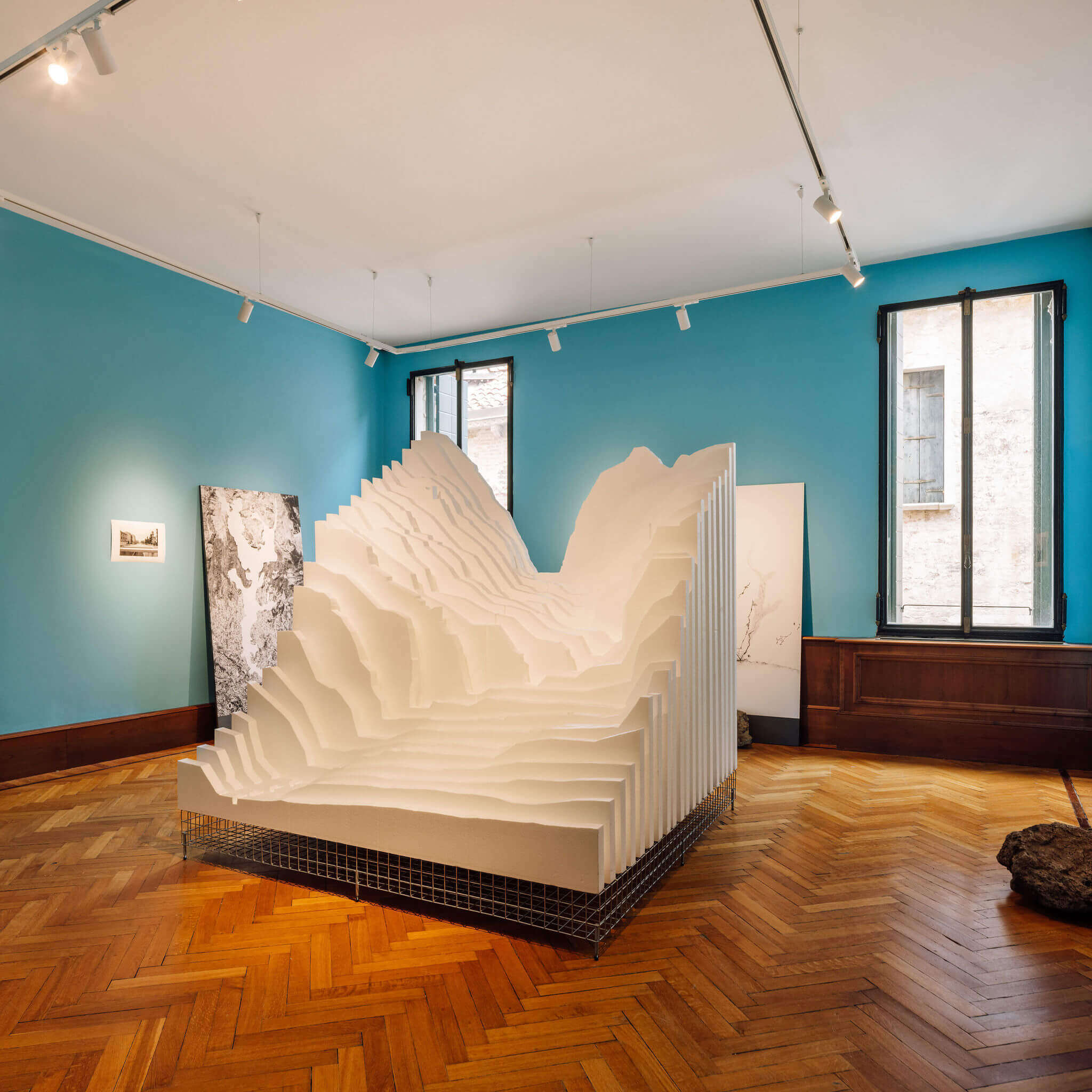
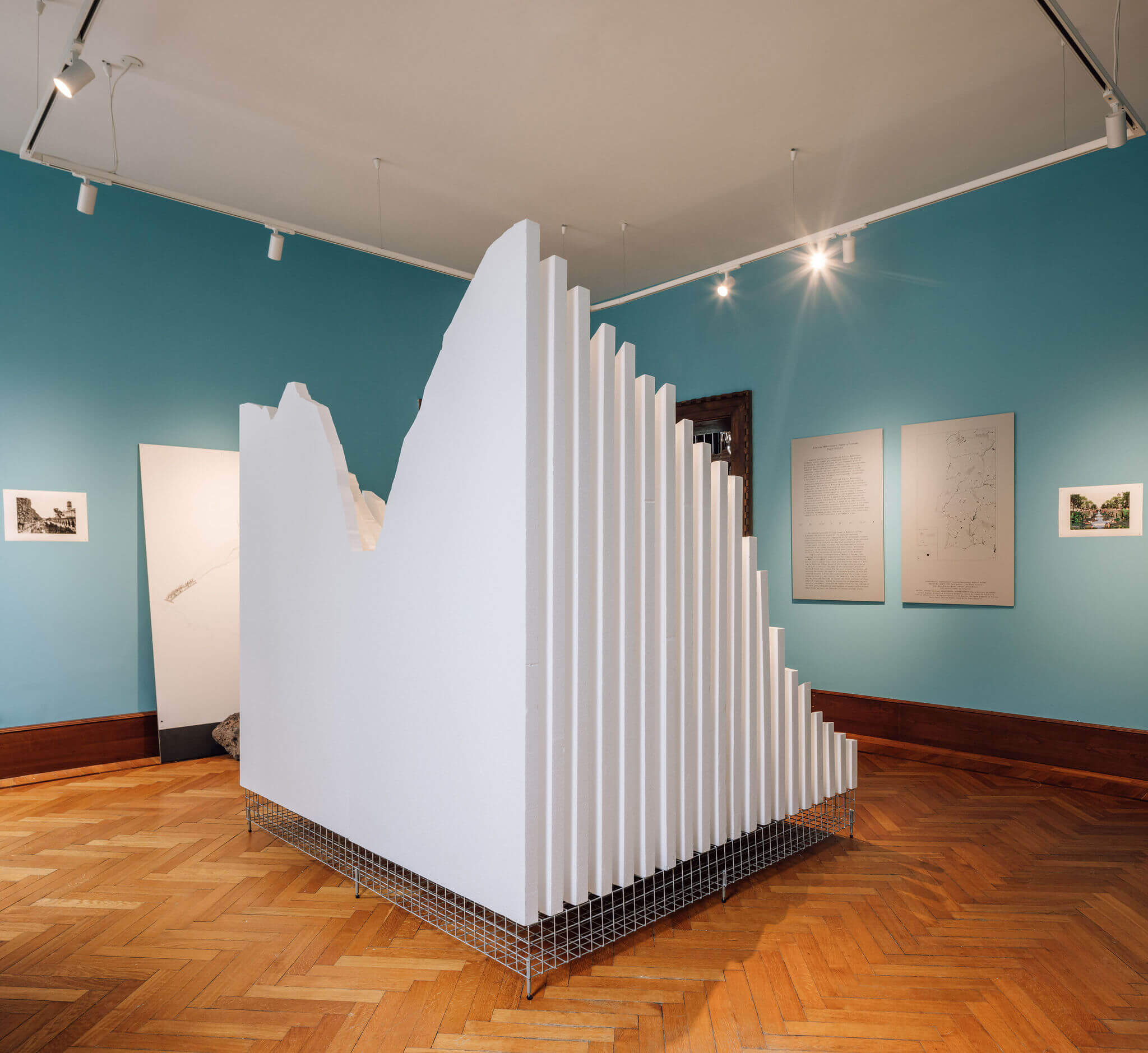
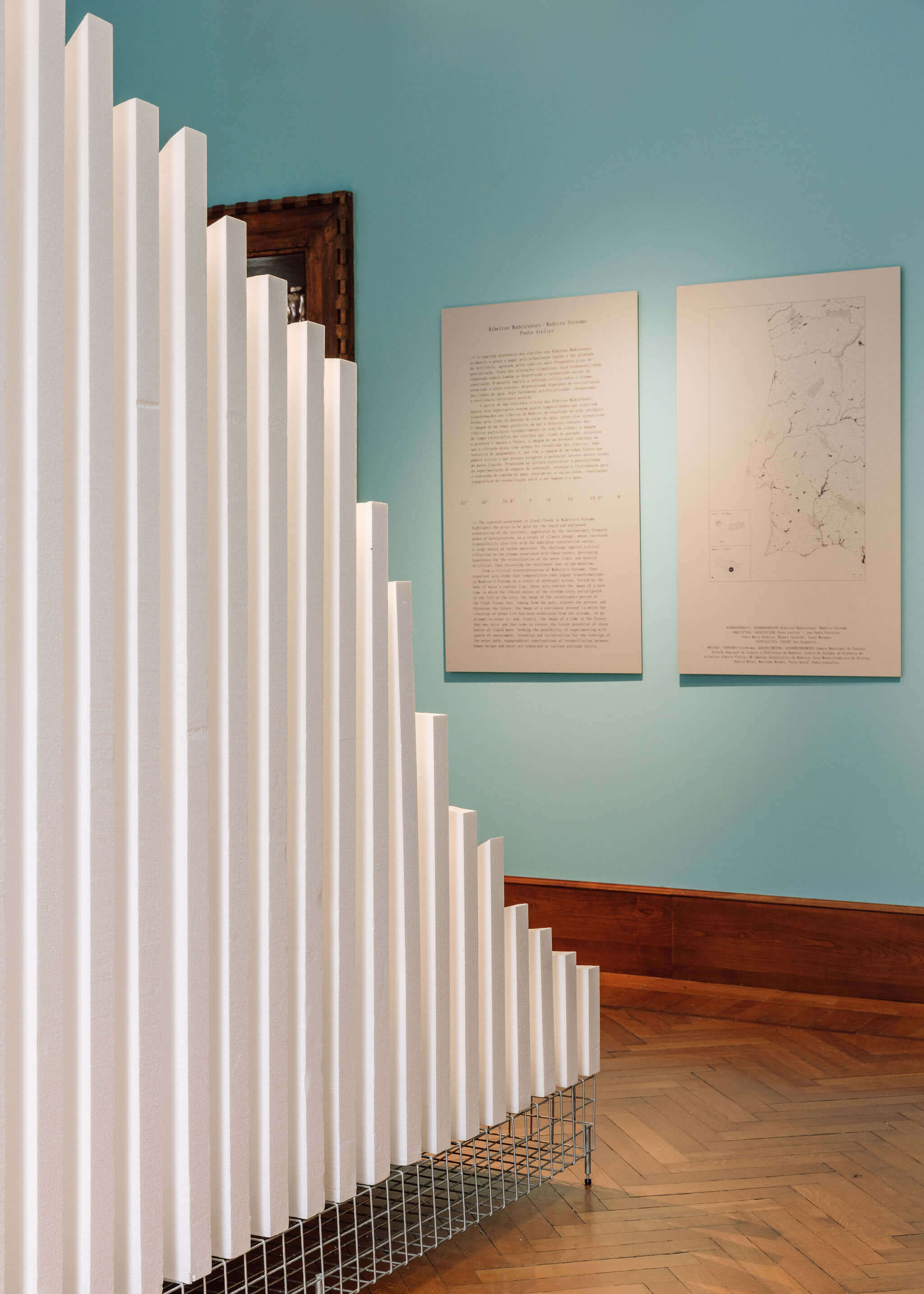
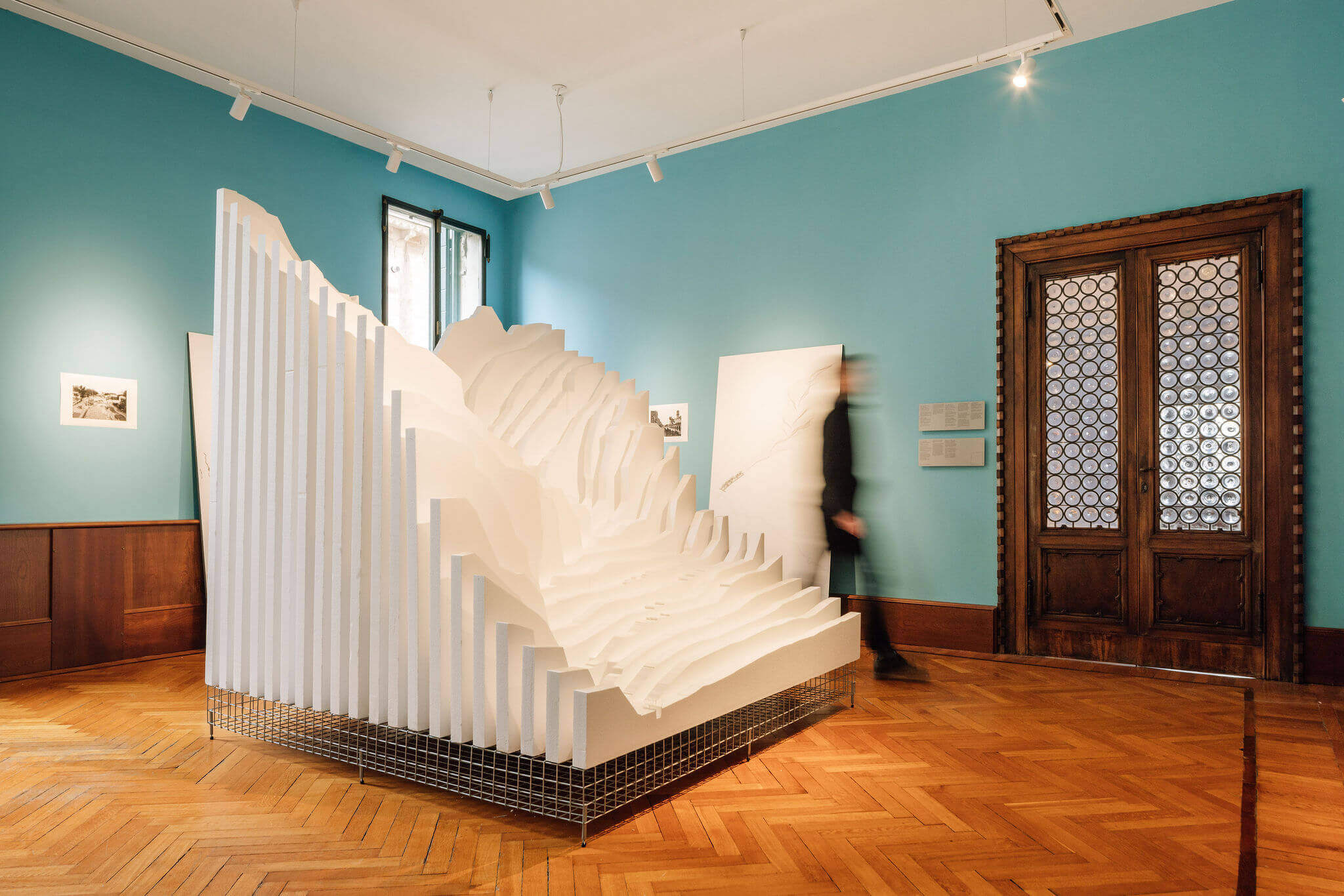
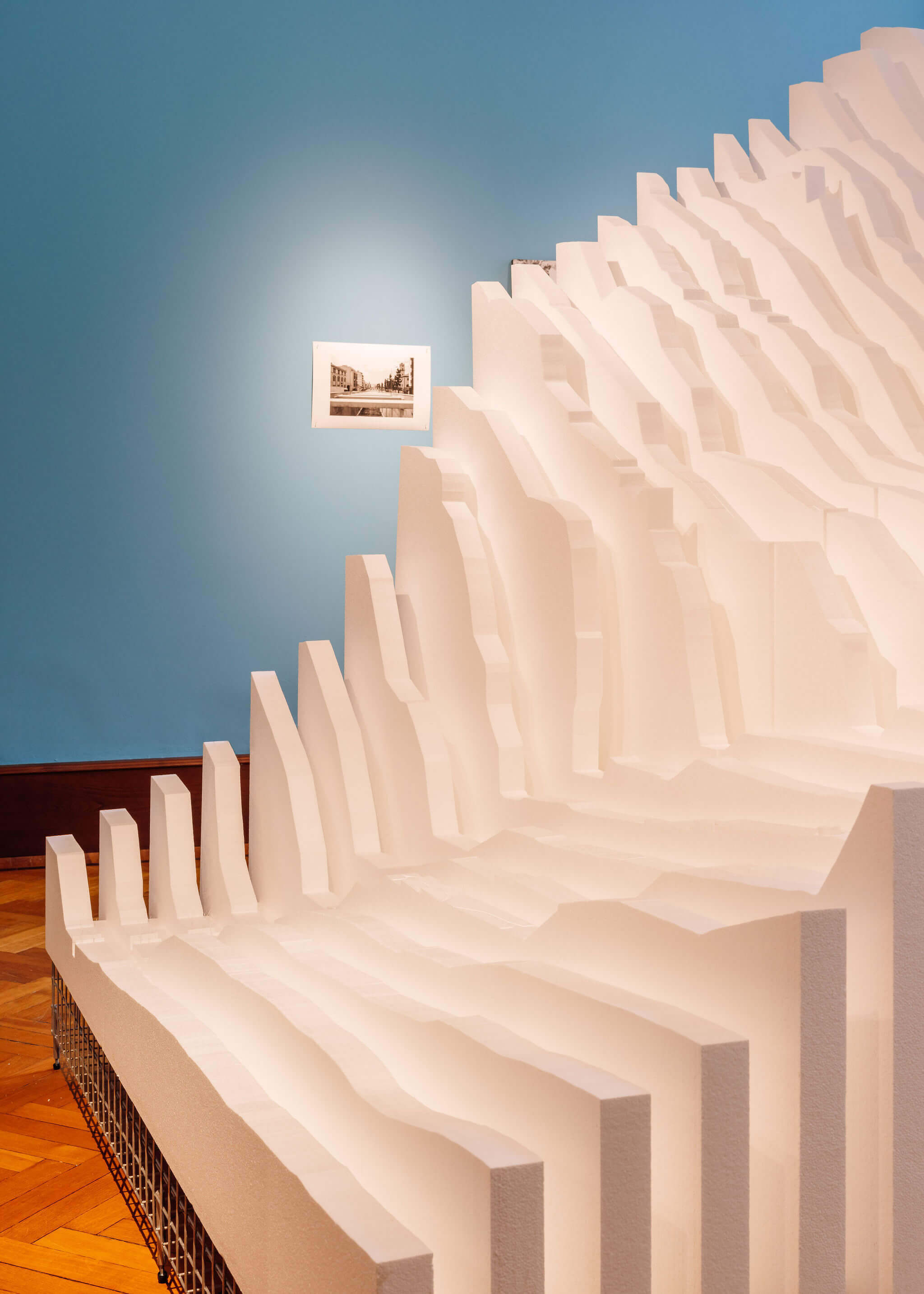
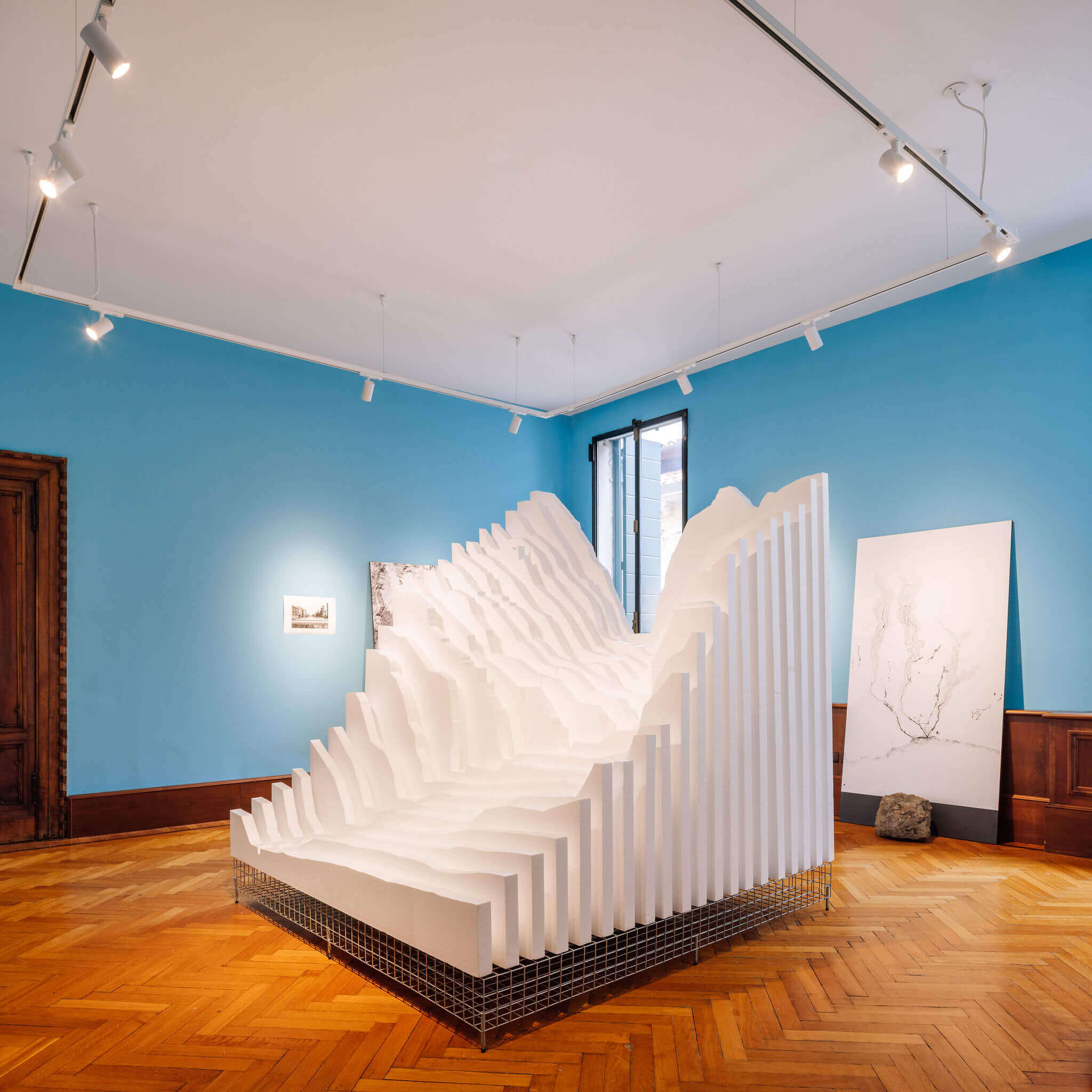
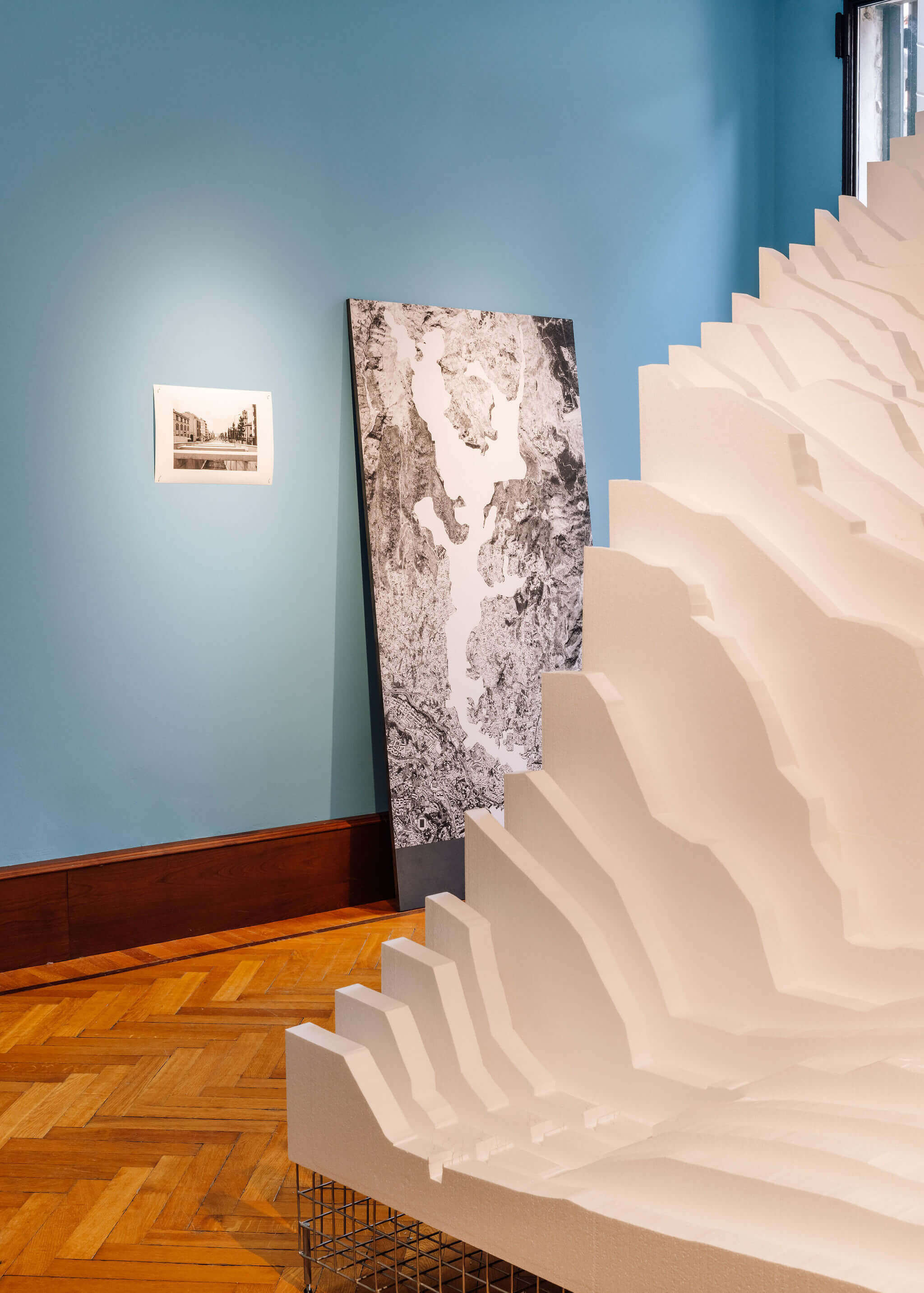
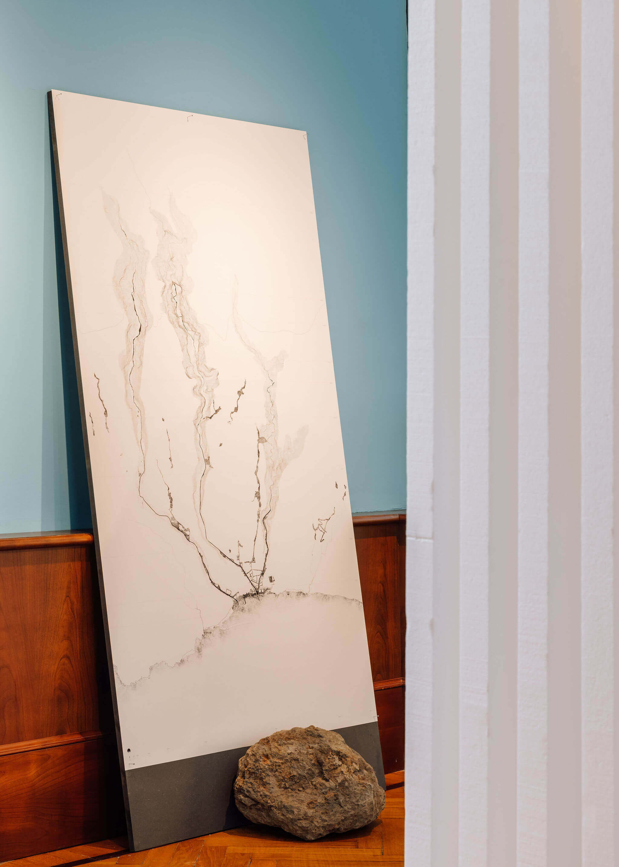
The repeated occurrence of flash floods in Madeira’s Streams highlights the price to be paid for the rapid and unplanned urbanisation of the territory, aggravated by the increasingly frequent peaks of precipitation, as a result of climate change, whose increased responsibility also lies with the unbridled construction sector, a large source of carbon emissions. The challenge implies critical reflection on the trauma associated with these events, developing hypotheses for the revitalisation of the water lines, now heavily artificial, thus recovering the resilience lost in the meantime.
From a critical reinterpretation of Madeira’s Streams, four expectant acts evoke four temporalities that signal transformations in Madeira’s Streams as a result of anthropic action. United by the body of water’s contour line, these acts rewrite the image of a past time in which the vibrant nature of the streams truly participated in the life of the city; the image of the catastrophic period of the flash floods that, coming from the past, crosses the present and threatens the future; the image of a continuous present in which the vibration of urban life has been eradicated from the streams, in an attempt to erase it; and, finally, the image of a time in the future that may exist and that aims to recover the latent potential of these bodies of liquid mass. Seeking the possibility of experimenting with spaces of containment, retention and (re)direction for the redesign of the water path, topographical constructions of reconciliation between human beings and water are rehearsed at various altitude levels.
ACKNOWLEDGEMENTS Câmara Municipal do Funchal, Direção Regional do Arquivo e Biblioteca da Madeira, Centro de Estudos de História do Atlântico Alberto Vieira, JM/ Empresa Jornalística da Madeira, Casa-Museu Frederico de Freitas, Danilo Matos, Martinho Mendes, Paulo David, Pedro Gonçalves

Fotografia da Ribeira de Santa Luzia, Funchal, anterior a 1897.
B/w photograph printed on 300gr cotton paper
– MEMORY OF THE STREAM
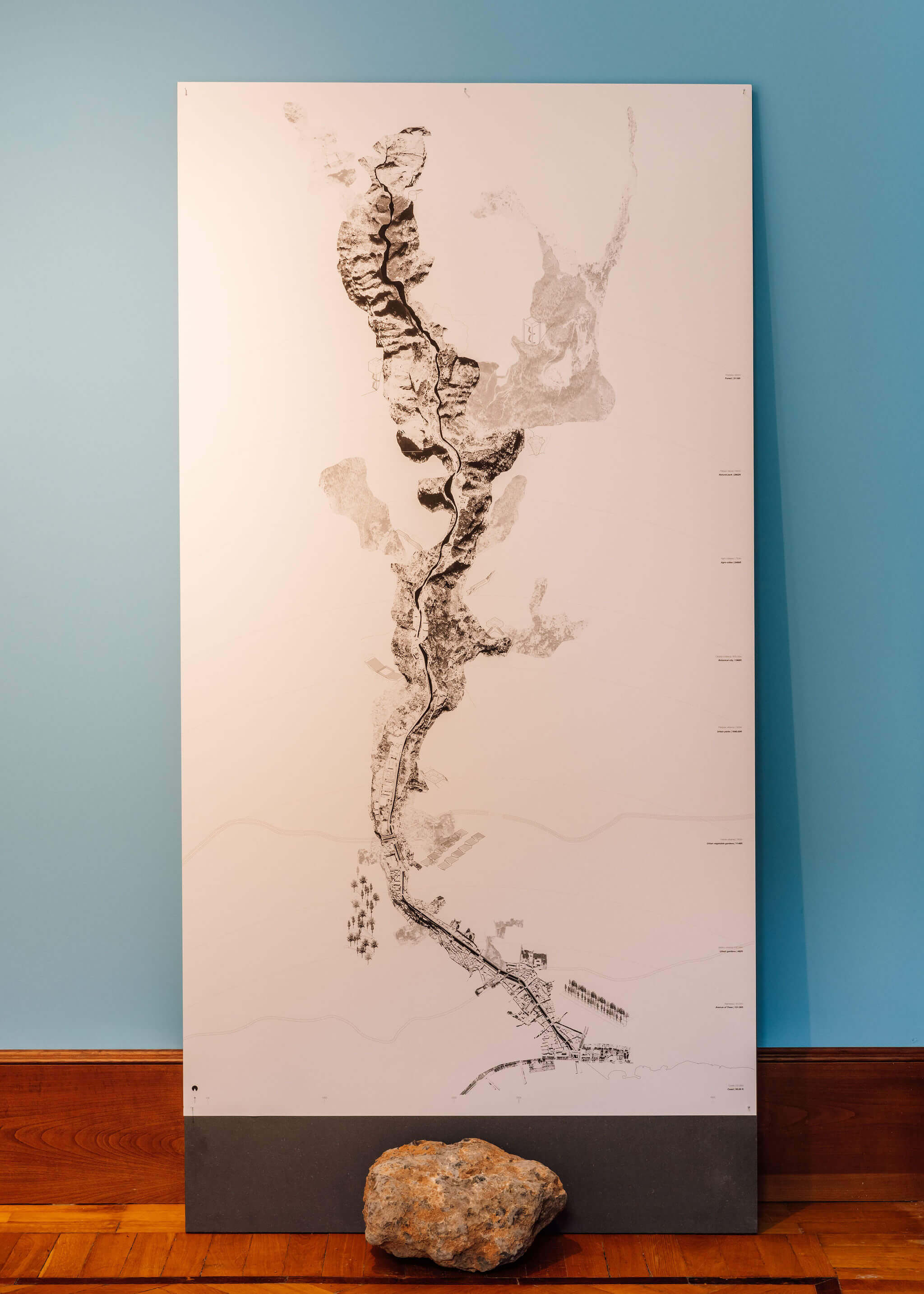
Representation of Santa Luzia Stream from elevation 0.00 to elevation 900
Line drawing and b/w image on 300gr cotton paper
– BASALT ROCK
Geographical origin: Ribeira de Santa Luzia, Ilha da Madeira, Portugal
The slow pace, the water, the hot rock of the stream, the shade of the bougainvillaes, the sound of the birds and the smell of the trees along the avenues. The Stream is part of the city as a finishing piece of the abrupt topography, and leads the watercourse through the deep valley that designs its way down to the sea.
Photograph of the flash flood in João Gomes Stream, Funchal, Portugal, 2010. ©élvio Fernandes and JM
B/w photograph printed on 300 gr cotton paper
– DESTRUCTION AND TRANSFORMATION
Representation of the Flash Floods to the present day
Line drawing and b/w image on 300gr cotton paper
– BASALT ROCK
Geographical origin: Ribeira de Santa Luzia, Ilha da Madeira, Portugal
Downward destruction. The water finds its way, it invades the city, the streets, the squares, the houses. Nature translates into an aggressive response to anthropisation, sculpting the territory, destroying and transforming the city.
Santa Luzia stream, after the hydraulic engineering interventions Funchal’s streams after the flash flood of 2010, Funchal, Portugal, September 2017. © Danilo Matos.
B/w photograph printed on 300gr cotton pape
– ERASURE OF MEMORY
Representation of the absence of the stream through an orthographic image
Line drawing and b/w image on 300gr cotton paper
– BASALT ROCK
Geographical origin: Ribeira de Santa Luzia, Ilha da Madeira, Portugal
The irreversible action of a stream becomes a pipeline. The noise from cars, the enclosed balconies, the hot tar invades the sidewalks. The erasing of the memory of past values.
Digital collage overlapping a current photograph of Santa Luzia Stream, 2023
Coloured print on 300gr cotton paper
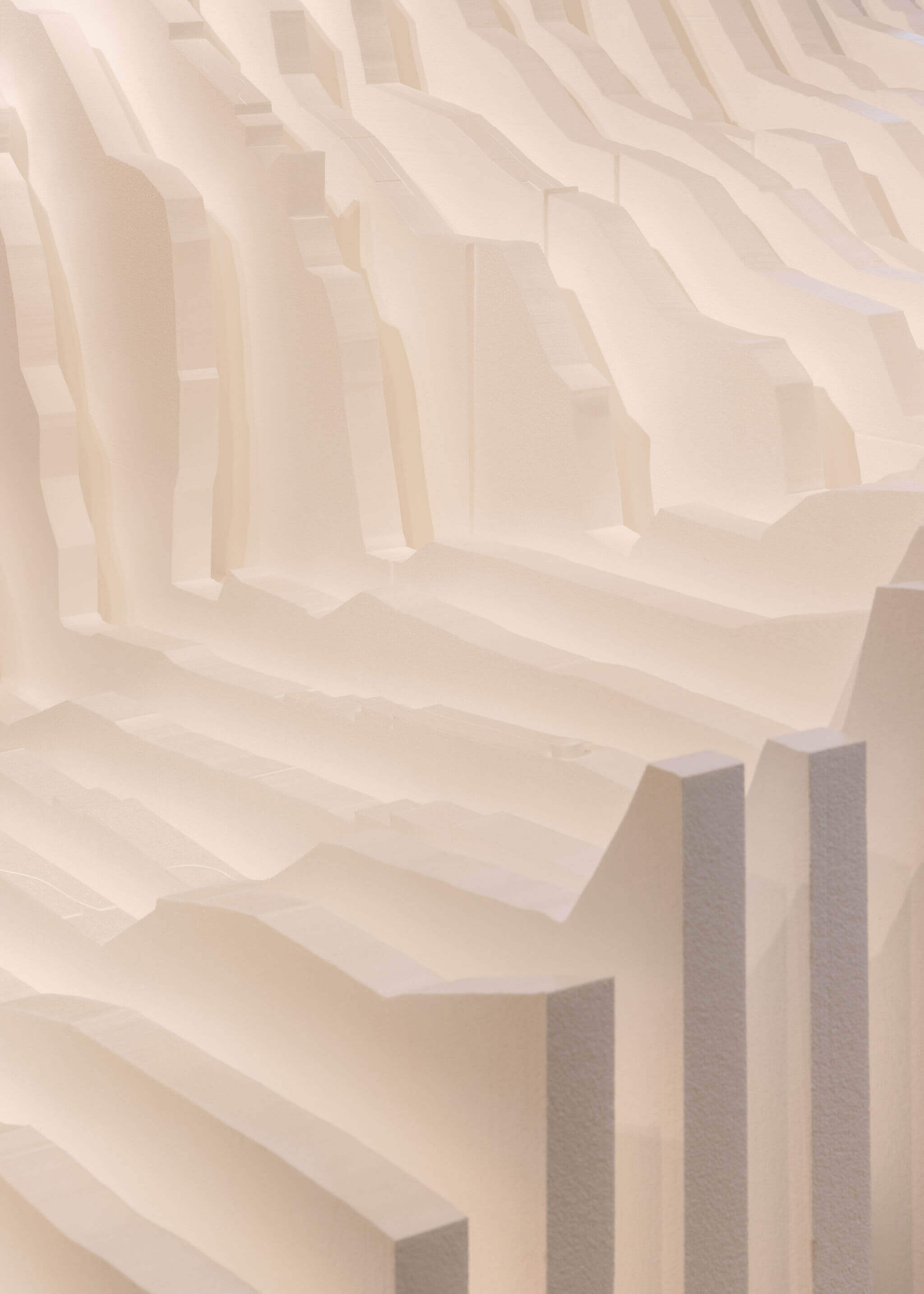
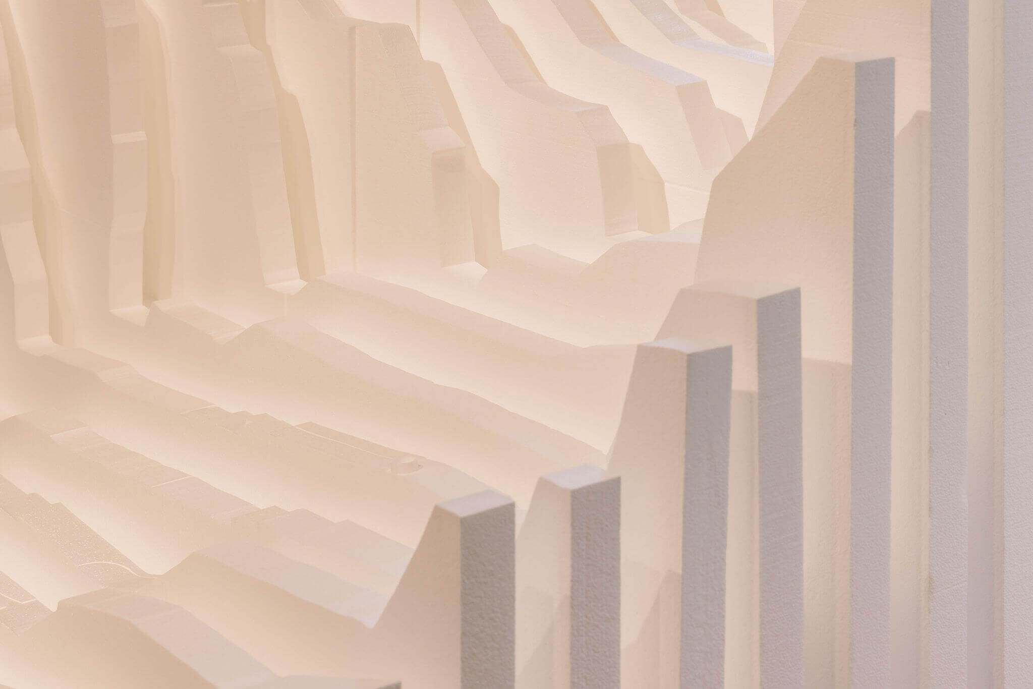
– THE NEW PATH OF WATER
Representation of the stream through an orthographic image depicting stratification at various elevations and propositional typologies
Line drawing and b/w image on 300gr cotton paper
– BASALT ROCK
Geographical origin: Ribeira de Santa Luzia, Ilha da Madeira, Portugal
The redesign of the water path. A territorial and stratified reading of the Stream at various elevations gives rise to an idea of the future, through spatial and typological tests of topographical constructions that adhere to the geological body to contain, direct and store the liquid mass that enables the reactivation of spaces, maintenance of gardens and the nurturing of shaded lanes and sidewalks.
XPS Styrofoam, high density White colour
Pontoatelier — Tonny Marques
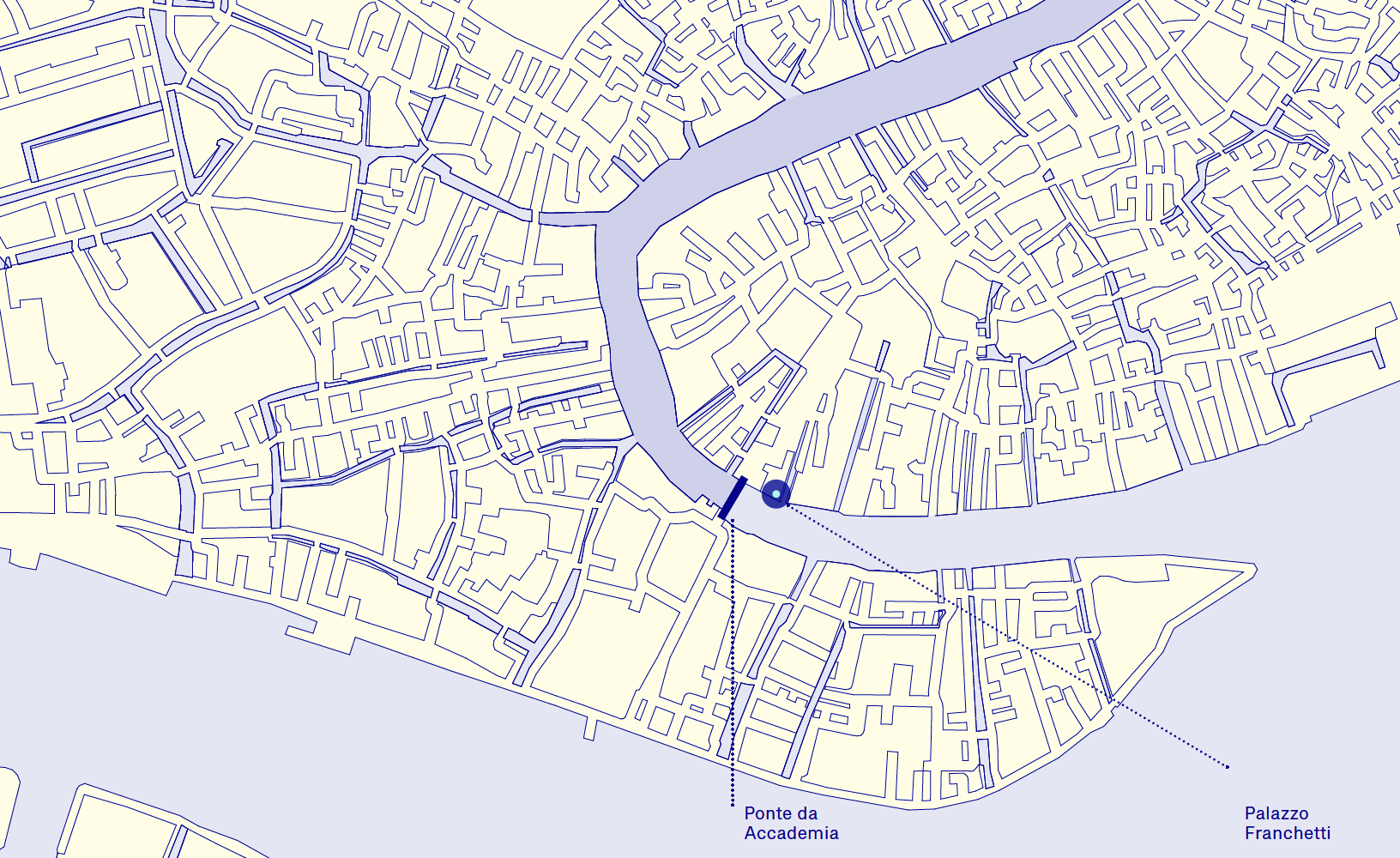
S. Marco, 2847, 30124 Venezia VE, Itália
(Ao lado da Ponte da Accademia)
Vaporetto Accademia
Lines: 1, 2
Terça a Domingo: 10:00 — 18:00
Fechado às segundas-feiras excepto:
22.05, 14.08, 4.09, 16.10, 30.10, 20.11
communication@fertilefutures.pt
www.fertilefutures.pt
www.instagram.com/fertilefutures
www.facebook.com/fertilefuturespt
Ministério da Cultura
Gabinete de Imprensa
Palácio Nacional da Ajuda
1300-018 Lisboa
ceunovais@mc.gov.pt
clara.henriques@mc.gov.pt
tel. +351 213614500
Direção-Geral das Artes
Comunicação
Campo Grande, n.º 83-1º
1700-088 Lisboa
comunicacao@dgartes.pt
tel. +351 21 150 70 10
www.dgartes.gov.pt
www.facebook.com/dgartes
www.instagram.com/dg.artes
communication@fertilefutures.pt
g.ruffino@thelinkpr.it
#BiennaleArchitettura2023
#LesleyLokko
#pavilhaoportugal2023
#portugalpavilion2023
#dgartes